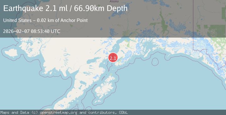
Earthquake 20 km W of Anchor Point, Alaska
Sat, 07 Feb 2026 08:53:40 GMT
Time1 hour ago
Location
59.7680, -152.2020
Depth
66.9 KM
Event Summary
A 2.1 magnitude earthquake struck on 20 km W of Anchor Point, Alaska, at Sat, 07 Feb 2026 08:53:40 GMT. Depth: 66.9km. Reviewed by USGS seismologists, this minor quake occurred at a magnitude type of ml.
Magnitude
2.1
ml
Source
USGS
Intensity
-
Agency Reports
1 Sources| Source | Magnitude | Depth | Time |
|---|---|---|---|
| USGSPrimary | 2.1 | 67 km | 1 hour ago |
Earthquake Details
AutomaticEvent IDusgs_ak2026cqpolp
Tsunami PotentialNo
Magnitude Typeml
Nearest Places
- Anchor Point18.7 km
- Anchor Point Light18.9 km
- Granroos Creek19.5 km
- Anchor River19.5 km
- Anchor River Airpark19.6 km
Comments
Join the discussion about this event.
Latest Earthquakes
2.1Mag
17 km W of Nikiski, Alaska
Time11 minutes ago
Depth67.80 km
SourceUSGS (Automatic)
2.9Mag
Southern Sumatra, Indonesia
Time12 minutes ago
Depth16.02 km
SourceBMKG (Automatic)
3.4Mag
CENTRAL ALASKA
Time23 minutes ago
Depth131.20 km
SourceAK (Automatic)
1.5Mag
CENTRAL TURKEY
Time28 minutes ago
Depth7.10 km
SourceAFAD (Automatic)
3.0Mag
OFFSHORE VALPARAISO, CHILE
Time30 minutes ago
Depth10.00 km
SourceCSN (Automatic)
Nearby Earthquakes
2.5Mag
SOUTHERN ALASKA
Time1 week ago
Depth72.00 km
SourceAK (Automatic)
2.5Mag
37 km WSW of Anchor Point, Alaska
Time1 week ago
Depth93.10 km
SourceUSGS (Automatic)
2.6Mag
28 km WNW of Happy Valley, Alaska
Time1 week ago
Depth76.30 km
SourceUSGS (Automatic)
1.8Mag
4 km WNW of Happy Valley, Alaska
Time1 week ago
Depth49.00 km
SourceUSGS (Automatic)
2.1Mag
48 km WNW of Anchor Point, Alaska
Time11 hours ago
Depth100.30 km
SourceUSGS (Automatic)