Earthquake southern Sumatra, Indonesia
Mon, 16 Feb 2026 06:00:40 GMT
Time3 days ago
Location
-0.4998, 99.2008
Depth
73.1 KM
Event Summary
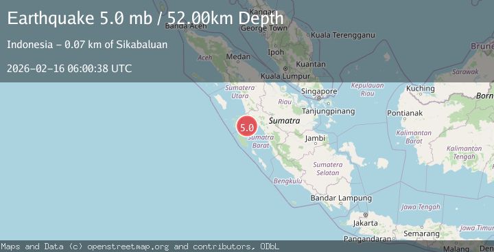
A 5.4 magnitude earthquake struck on southern Sumatra, Indonesia, at Mon, 16 Feb 2026 06:00:40 GMT. Depth: 73.1201171875km. Reviewed by VYT seismologists, this moderate quake occurred at a magnitude type of earthquake.
Magnitude
5.4
earthquake
Source
VYT
Intensity
-
Agency Reports
5 Sources| Source | Magnitude | Depth | Time |
|---|---|---|---|
| VYTPrimary | 5.4 | 73 km | 3 days ago |
| BMKG | 5.2 | 48 km | 3 days ago |
| NEIC | 5.0 | 60 km | 3 days ago |
| USGS | 5.0 | 60 km | 3 days ago |
| EMSC | 5.0 | 52 km | 3 days ago |
Earthquake Details
AutomaticEvent IDvyt_6cvam492nro3
Tsunami PotentialNo
Magnitude Typeearthquake
Nearest Places
- Karang Drakes16.3 km
- Karang West Pylades20.2 km
- Karang East Pylades26.0 km
- Karang Moller52.9 km
- Karang Sagi54.5 km
Comments
Join the discussion about this event.
Latest Earthquakes
3.2Mag
NEAR EAST COAST OF HONSHU, JAPAN
Time2 hours ago
Depth30.00 km
SourceJMA (Automatic)
4.6Mag
Kepulauan Talaud, Indonesia
Time2 hours ago
Depth10.00 km
SourceVYT (Automatic)
2.5Mag
Java, Indonesia
Time2 hours ago
Depth16.25 km
SourceBMKG
0.9Mag
16 km NE of Whittier, Alaska
Time2 hours ago
Depth5.00 km
SourceUSGS (Automatic)
2.2Mag
Southern Alaska
Time2 hours ago
Depth100.83 km
SourceVYT (Automatic)
Nearby Earthquakes
3.0Mag
SOUTHERN SUMATRA, INDONESIA
Time11 months ago
Depth56.00 km
SourceBMKG (Automatic)
3.0Mag
SOUTHERN SUMATRA, INDONESIA
Time10 months ago
Depth10.00 km
SourceBMKG (Automatic)
2.9Mag
Southern Sumatra, Indonesia
Time1 week ago
Depth10.00 km
SourceBMKG (Automatic)
3.0Mag
SOUTHERN SUMATRA, INDONESIA
Time5 months ago
Depth18.00 km
SourceBMKG (Automatic)
3.6Mag
Southern Sumatra, Indonesia
Time2 weeks ago
Depth41.61 km
SourceBMKG (Automatic)