Earthquake Southern Sumatra, Indonesia
Sun, 08 Feb 2026 06:08:21 GMT
Time1 hour ago
Location
-0.4053, 99.2076
Depth
10.0 KM
Event Summary
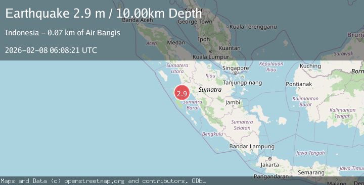
A 2.9 magnitude earthquake struck on Southern Sumatra, Indonesia, at Sun, 08 Feb 2026 06:08:21 GMT. Depth: 10km. Reviewed by BMKG seismologists, this minor quake occurred at a magnitude type of M.
Magnitude
2.9
M
Source
BMKG
Intensity
-
Agency Reports
1 Sources| Source | Magnitude | Depth | Time |
|---|---|---|---|
| BMKGPrimary | 2.9 | 10 km | 1 hour ago |
Earthquake Details
AutomaticEvent IDbmg2026crxg
Tsunami PotentialNo
Magnitude TypeM
Nearest Places
- Karang Drakes6.6 km
- Karang West Pylades14.8 km
- Karang East Pylades23.4 km
- Karang Moller43.2 km
- Karang Van Speijk45.5 km
Comments
Join the discussion about this event.
Latest Earthquakes
1.2Mag
19 km NNE of Four Mile Road, Alaska
Time11 minutes ago
Depth5.00 km
SourceUSGS (Automatic)
2.0Mag
Sumbawa Region, Indonesia
Time11 minutes ago
Depth126.95 km
SourceBMKG (Automatic)
2.2Mag
Sulawesi, Indonesia
Time12 minutes ago
Depth5.00 km
SourceBMKG (Automatic)
1.2Mag
SWITZERLAND
Time17 minutes ago
Depth4.10 km
SourceETHZ (Automatic)
2.6Mag
ATACAMA, CHILE
Time19 minutes ago
Depth7.30 km
SourceCSN (Automatic)
Nearby Earthquakes
3.6Mag
Southern Sumatra, Indonesia
Time1 week ago
Depth41.61 km
SourceBMKG (Automatic)
2.7Mag
Southern Sumatra, Indonesia
Time1 week ago
Depth22.17 km
SourceBMKG (Automatic)
2.8Mag
Southern Sumatra, Indonesia
Time1 week ago
Depth38.19 km
SourceBMKG (Automatic)
2.9Mag
Southern Sumatra, Indonesia
Time21 hours ago
Depth16.02 km
SourceBMKG (Automatic)
3.0Mag
Southern Sumatra, Indonesia
Time5 days ago
Depth10.00 km
SourceBMKG (Automatic)