Earthquake east of Australia
Thu, 19 Feb 2026 07:15:41 GMT
Time1 hour ago
Location
-25.0162, 161.3756
Depth
10.0 KM
Event Summary
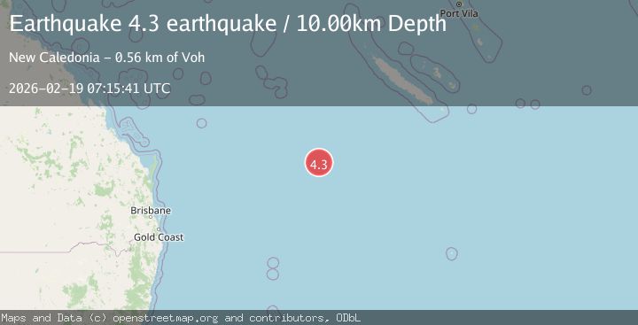
A 4.3 magnitude earthquake struck on east of Australia, at Thu, 19 Feb 2026 07:15:41 GMT. Depth: 10km. Reviewed by VYT seismologists, this light quake occurred at a magnitude type of earthquake.
Magnitude
4.3
earthquake
Source
VYT
Intensity
-
Agency Reports
1 Sources| Source | Magnitude | Depth | Time |
|---|---|---|---|
| VYTPrimary | 4.3 | 10 km | 1 hour ago |
Earthquake Details
AutomaticEvent IDvyt_7ytz41xw0ldh
Tsunami PotentialNo
Magnitude Typeearthquake
Nearest Places
- Capel Bank174.0 km
- Kelso Reef211.9 km
- Capel Tablemount215.8 km
- Gifford Marine Park266.5 km
- Argo Bank273.6 km
Comments
Join the discussion about this event.
Latest Earthquakes
2.6Mag
Sumba Region, Indonesia
Time25 minutes ago
Depth13.08 km
SourceBMKG
2.1Mag
Tarapaca, Chile
Time26 minutes ago
Depth115.11 km
SourceVYT (Automatic)
1.7Mag
35 km SSE of King Salmon, Alaska
Time27 minutes ago
Depth9.10 km
SourceUSGS (Automatic)
2.1Mag
Sweden
Time31 minutes ago
Depth0.00 km
SourceVYT (Automatic)
2.2Mag
Minahassa Peninsula, Sulawesi
Time32 minutes ago
Depth24.60 km
SourceBMKG
Nearby Earthquakes
5.6Mag
NEAR EAST COAST OF AUSTRALIA
Time10 years ago
Depth10.00 km
SourceEMSC (Automatic)
5.7Mag
NEAR EAST COAST OF AUSTRALIA
Time10 years ago
Depth33.00 km
SourceEMSC (Automatic)
5.3Mag
NEAR EAST COAST OF AUSTRALIA
Time10 years ago
Depth10.00 km
SourceEMSC (Automatic)
5.0Mag
SOUTHWEST OF NEW CALEDONIA
Time19 years ago
Depth360.00 km
SourceEMSC (Automatic)
5.1Mag
EAST OF AUSTRALIA
Time21 years ago
Depth30.00 km
SourceNEIC (Automatic)