Earthquake Southeastern Alaska
Tue, 17 Feb 2026 10:12:29 GMT
Time1 day ago
Location
60.7227, -140.7375
Depth
16.2 KM
Event Summary
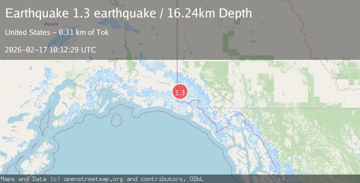
A 1.3 magnitude earthquake struck on Southeastern Alaska, at Tue, 17 Feb 2026 10:12:29 GMT. Depth: 16.2353515625km. Reviewed by VYT seismologists, this minor quake occurred at a magnitude type of earthquake.
Magnitude
1.3
earthquake
Source
VYT
Intensity
-
Agency Reports
1 Sources| Source | Magnitude | Depth | Time |
|---|---|---|---|
| VYTPrimary | 1.3 | 16 km | 1 day ago |
Earthquake Details
AutomaticEvent IDvyt_8458g85esayc
Tsunami PotentialNo
Magnitude Typeearthquake
Nearest Places
- Ogilvie Glacier4.5 km
- Mussell Glacier9.8 km
- Logan Glacier14.3 km
- King Peak16.2 km
- Walsh Glacier17.8 km
Comments
Join the discussion about this event.
Latest Earthquakes
2.1Mag
Tarapaca, Chile
Time4 minutes ago
Depth8.18 km
SourceVYT (Automatic)
1.4Mag
12 km ESE of Olancha, CA
Time5 minutes ago
Depth7.15 km
SourceUSGS (Automatic)
2.8Mag
northwestern Russia
Time6 minutes ago
Depth10.00 km
SourceVYT (Automatic)
3.3Mag
Near North Coast of West Papua
Time6 minutes ago
Depth10.00 km
SourceBMKG
1.2Mag
5 km NNE of Fishhook, Alaska
Time7 minutes ago
Depth0.80 km
SourceUSGS (Automatic)
Nearby Earthquakes
2.1Mag
Southeastern Alaska
Time2 days ago
Depth0.00 km
SourceVYT (Automatic)
1.5Mag
Southeastern Alaska
Time23 hours ago
Depth0.00 km
SourceVYT (Automatic)
1.2Mag
126 km SE of McCarthy, Alaska
Time1 week ago
Depth8.30 km
SourceUSGS (Automatic)
1.3Mag
Southeastern Alaska
Time6 days ago
Depth0.00 km
SourceVYT (Automatic)
1.8Mag
Southeastern Alaska
Time1 day ago
Depth0.00 km
SourceVYT (Automatic)