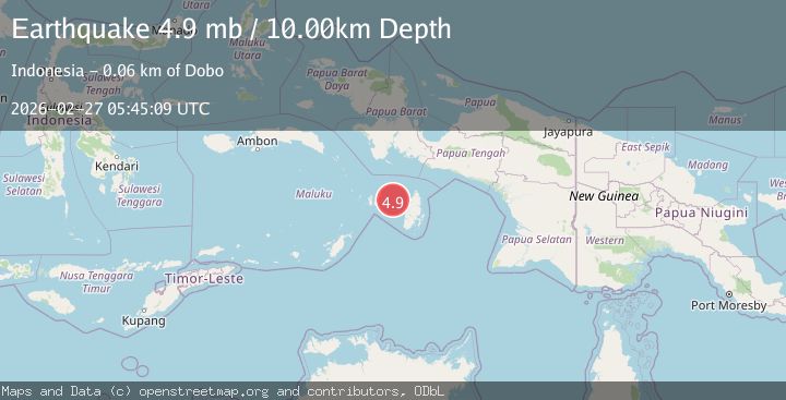
Earthquake Kepulauan Aru region, Indonesia
Fri, 27 Feb 2026 05:45:05 GMT
Time1 hour ago
Location
-5.8048, 134.0637
Depth
3.9 KM
Event Summary
A 4.9 magnitude earthquake struck on Kepulauan Aru region, Indonesia, at Fri, 27 Feb 2026 05:45:05 GMT. Depth: 3.90625km. Reviewed by VYT seismologists, this light quake occurred at a magnitude type of earthquake.
Magnitude
4.9
earthquake
Source
VYT
Intensity
-
Agency Reports
2 Sources| Source | Magnitude | Depth | Time |
|---|---|---|---|
| VYTPrimary | 4.5 | 4 km | 1 hour ago |
| BMKG | 4.9 | 22 km | 1 hour ago |
Earthquake Details
AutomaticEvent IDvyt_cklbai95olo0
Tsunami PotentialNo
Magnitude Typeearthquake
Nearest Places
- 12.2 km
- 14.1 km
- 14.4 km
- 15.0 km
- 3Kora15.2 km
Comments
Join the discussion about this event.
Latest Earthquakes
3.7Mag
Kenai Peninsula, Alaska
Time1 minute ago
Depth40.16 km
SourceVYT (Automatic)
1.3Mag
Kodiak Island region, Alaska
Time4 minutes ago
Depth4.15 km
SourceVYT (Automatic)
3.7Mag
Timor region, Indonesia
Time5 minutes ago
Depth10.00 km
SourceVYT (Automatic)
1.5Mag
Tarapaca, Chile
Time5 minutes ago
Depth55.42 km
SourceVYT (Automatic)
1.6Mag
Central Alaska
Time11 minutes ago
Depth26.12 km
SourceVYT (Automatic)
Nearby Earthquakes
4.0Mag
KEPULAUAN ARU REGION, INDONESIA
Time6 years ago
Depth10.00 km
SourceDJA (Automatic)
3.0Mag
KEPULAUAN KAI, INDONESIA
Time3 years ago
Depth96.00 km
SourceDJA (Automatic)
5.7Mag
KEPULAUAN KAI, INDONESIA
Time13 years ago
Depth10.00 km
SourceEMSC (Automatic)
3.8Mag
KEPULAUAN ARU REGION, INDONESIA
Time6 days ago
Depth35.00 km
SourceBMKG (Automatic)
5.7Mag
KEPULAUAN KAI, INDONESIA
Time11 years ago
Depth14.00 km
SourceEMSC (Automatic)