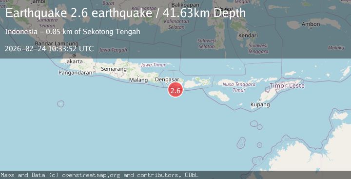
Earthquake south of Bali, Indonesia
Tue, 24 Feb 2026 10:33:52 GMT
Time1 hour ago
Location
-9.1975, 115.9718
Depth
41.6 KM
Event Summary
A 2.6 magnitude earthquake struck on south of Bali, Indonesia, at Tue, 24 Feb 2026 10:33:52 GMT. Depth: 41.6259765625km. Reviewed by VYT seismologists, this minor quake occurred at a magnitude type of earthquake.
Magnitude
2.6
earthquake
Source
VYT
Intensity
-
Agency Reports
1 Sources| Source | Magnitude | Depth | Time |
|---|---|---|---|
| VYTPrimary | 2.6 | 42 km | 1 hour ago |
Earthquake Details
AutomaticEvent IDvyt_gzkypn14ks31
Tsunami PotentialNo
Magnitude Typeearthquake
Nearest Places
- 30.5 km
- 33.3 km
- 33.3 km
- 34.2 km
- 34.4 km
Comments
Join the discussion about this event.
Latest Earthquakes
3.0Mag
Fox Islands, Aleutian Islands, Alaska
Time1 hour ago
Depth7.81 km
SourceVYT (Automatic)
1.0Mag
SLOVENIA
Time1 hour ago
Depth10.00 km
SourceOGS (Automatic)
1.5Mag
Tarapaca, Chile
Time1 hour ago
Depth52.49 km
SourceVYT (Automatic)
3.2Mag
Fox Islands, Aleutian Islands, Alaska
Time1 hour ago
Depth0.00 km
SourceVYT (Automatic)
2.6Mag
Timor Region
Time1 hour ago
Depth6.68 km
SourceBMKG
Nearby Earthquakes
2.5Mag
South of Bali, Indonesia
Time3 weeks ago
Depth68.01 km
SourceBMKG (Automatic)
3.0Mag
LOMBOK REGION, INDONESIA
Time5 years ago
Depth79.00 km
SourceDJA (Automatic)
3.0Mag
SOUTH OF BALI, INDONESIA
Time4 years ago
Depth68.00 km
SourceDJA (Automatic)
2.5Mag
SOUTH OF BALI, INDONESIA
Time1 month ago
Depth16.00 km
SourceBMKG (Automatic)
3.0Mag
LOMBOK REGION, INDONESIA
Time1 month ago
Depth33.00 km
SourceBMKG (Automatic)