Earthquake SOUTH OF BALI, INDONESIA
Tue, 13 Jan 2026 17:30:54 GMT
Time1 month ago
Location
-9.3800, 115.9100
Depth
16.0 KM
Event Summary
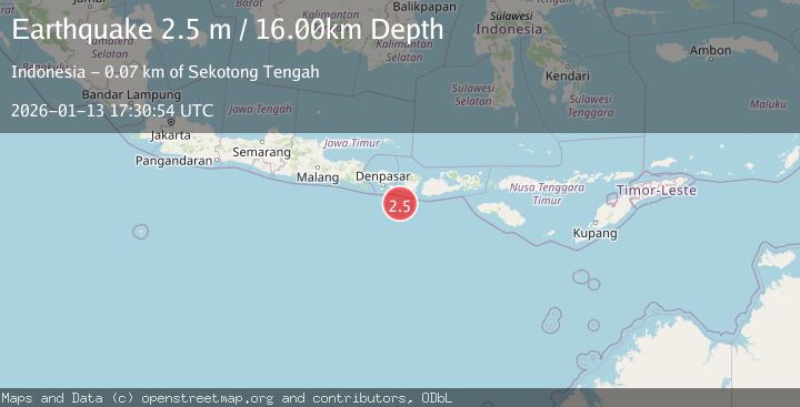
A 2.5 magnitude earthquake struck on SOUTH OF BALI, INDONESIA, at Tue, 13 Jan 2026 17:30:54 GMT. Depth: 16km. Reviewed by BMKG seismologists, this minor quake occurred at a magnitude type of m.
Magnitude
2.5
m
Source
BMKG
Intensity
-
Agency Reports
1 Sources| Source | Magnitude | Depth | Time |
|---|---|---|---|
| BMKGPrimary | 2.5 | 16 km | 1 month ago |
Earthquake Details
AutomaticEvent IDemsc_BMKG_20260113_0000265
Tsunami PotentialNo
Magnitude Typem
Nearest Places
- Lombok Basin51.4 km
- Pulau Sophialouisa51.6 km
- Gili Sarangburung54.3 km
- Tanjung Panggang54.6 km
- Gili Luah55.1 km
Comments
Join the discussion about this event.
Latest Earthquakes
1.9Mag
Poland
Time34 seconds ago
Depth12.33 km
SourceVYT (Automatic)
1.7Mag
2 km NW of Enterprise, Nevada
Time9 minutes ago
Depth15.89 km
SourceUSGS (Automatic)
1.3Mag
Southeastern Alaska
Time10 minutes ago
Depth7.20 km
SourceVYT (Automatic)
0.8Mag
39 km NE of Amboy, Washington
Time11 minutes ago
Depth7.36 km
SourceUSGS (Automatic)
3.2Mag
ANDHRA PRADESH, INDIA
Time15 minutes ago
Depth4.70 km
SourceNDI (Automatic)
Nearby Earthquakes
2.9Mag
South of Bali, Indonesia
Time3 weeks ago
Depth27.22 km
SourceBMKG (Automatic)
2.5Mag
SOUTH OF BALI, INDONESIA
Time1 month ago
Depth25.00 km
SourceBMKG (Automatic)
2.5Mag
South of Bali, Indonesia
Time2 weeks ago
Depth68.01 km
SourceBMKG (Automatic)
2.5Mag
SOUTH OF BALI, INDONESIA
Time1 month ago
Depth30.00 km
SourceBMKG (Automatic)
3.0Mag
SOUTH OF BALI, INDONESIA
Time4 years ago
Depth29.00 km
SourceDJA (Automatic)