Earthquake South of Bali, Indonesia
Fri, 30 Jan 2026 17:29:07 GMT
Time1 hour ago
Location
-9.3230, 115.8878
Depth
68.0 KM
Event Summary
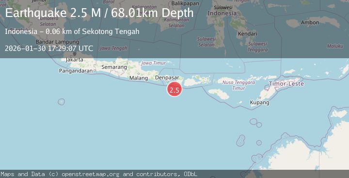
A 2.5 magnitude earthquake struck on South of Bali, Indonesia, at Fri, 30 Jan 2026 17:29:07 GMT. Depth: 68.008186km. Reviewed by BMKG seismologists, this minor quake occurred at a magnitude type of M.
Magnitude
2.5
M
Source
BMKG
Intensity
-
Agency Reports
1 Sources| Source | Magnitude | Depth | Time |
|---|---|---|---|
| BMKGPrimary | 2.5 | 68 km | 1 hour ago |
Earthquake Details
AutomaticEvent IDbmg2026ccif
Tsunami PotentialNo
Magnitude TypeM
Nearest Places
- Pulau Sophialouisa46.1 km
- Gili Sarangburung48.6 km
- Tanjung Panggang49.1 km
- Gili Luah49.3 km
- Gili Loangberayun50.0 km
Comments
Join the discussion about this event.
Latest Earthquakes
4.2Mag
MAGALLANES, CHILE
Time1 hour ago
Depth24.40 km
SourceCSN (Automatic)
4.4Mag
NEAR WEST COAST OF HONSHU, JAPAN
Time1 hour ago
Depth10.00 km
SourceJMA (Automatic)
2.1Mag
West Papua Region, Indonesia
Time1 hour ago
Depth22.29 km
SourceBMKG (Automatic)
3.1Mag
Java, Indonesia
Time1 hour ago
Depth38.79 km
SourceBMKG (Automatic)
2.4Mag
ISLAND OF HAWAII, HAWAII
Time1 hour ago
Depth27.70 km
SourceHV (Automatic)
Nearby Earthquakes
2.9Mag
South of Bali, Indonesia
Time6 days ago
Depth27.22 km
SourceBMKG (Automatic)
2.5Mag
South of Bali, Indonesia
Time10 hours ago
Depth37.73 km
SourceBMKG (Automatic)
2.6Mag
South of Bali, Indonesia
Time4 days ago
Depth158.81 km
SourceBMKG (Automatic)
2.7Mag
Sumbawa Region, Indonesia
Time1 week ago
Depth29.18 km
SourceBMKG (Automatic)
2.2Mag
Bali Region, Indonesia
Time6 days ago
Depth84.98 km
SourceBMKG (Automatic)