Earthquake southern Sumatra, Indonesia
Wed, 25 Feb 2026 17:49:28 GMT
Time6 hours ago
Location
-0.3897, 98.9844
Depth
13.4 KM
Event Summary
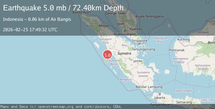
A 5.2 magnitude earthquake struck on southern Sumatra, Indonesia, at Wed, 25 Feb 2026 17:49:28 GMT. Depth: 13.427734375km. Reviewed by VYT seismologists, this moderate quake occurred at a magnitude type of earthquake.
Magnitude
5.2
earthquake
Source
VYT
Intensity
-
Agency Reports
2 Sources| Source | Magnitude | Depth | Time |
|---|---|---|---|
| VYTPrimary | 5.2 | 13 km | 6 hours ago |
| BMKG | 5.0 | 18 km | 6 hours ago |
Earthquake Details
AutomaticEvent IDvyt_mlx0vd912lv4
Tsunami PotentialNo
Magnitude Typeearthquake
Nearest Places
- 29.3 km
- 39.4 km
- 44.2 km
- 46.9 km
- 47.2 km
Comments
Join the discussion about this event.
Latest Earthquakes
2.3Mag
Sunda Strait, Indonesia
Time6 hours ago
Depth15.02 km
SourceBMKG
2.2Mag
western Texas
Time6 hours ago
Depth0.00 km
SourceVYT (Automatic)
1.7Mag
19 km ESE of Johannesburg, CA
Time6 hours ago
Depth3.35 km
SourceUSGS (Automatic)
3.0Mag
Southern Alaska
Time6 hours ago
Depth20.63 km
SourceVYT (Automatic)
3.8Mag
PUNJAB, INDIA
Time6 hours ago
Depth96.20 km
SourceNDI (Automatic)
Nearby Earthquakes
5.1Mag
SOUTHERN SUMATRA, INDONESIA
Time6 years ago
Depth53.00 km
SourceEMSC (Automatic)
5.0Mag
KEPULAUAN BATU, INDONESIA
Time10 years ago
Depth50.00 km
SourceEMSC (Automatic)
2.5Mag
SOUTHERN SUMATRA, INDONESIA
Time1 month ago
Depth10.00 km
SourceBMKG (Automatic)
2.7Mag
Southern Sumatra, Indonesia
Time1 month ago
Depth22.17 km
SourceBMKG (Automatic)
5.0Mag
SOUTHERN SUMATRA, INDONESIA
Time16 years ago
Depth60.00 km
SourceEMSC (Automatic)