Earthquake Southern California
Tue, 10 Feb 2026 16:32:29 GMT
Time1 week ago
Location
33.8151, -116.0524
Depth
17.3 KM
Event Summary
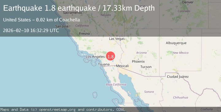
A 1.8 magnitude earthquake struck on Southern California, at Tue, 10 Feb 2026 16:32:29 GMT. Depth: 17.333984375km. Reviewed by VYT seismologists, this minor quake occurred at a magnitude type of earthquake.
Magnitude
1.8
earthquake
Source
VYT
Intensity
-
Agency Reports
2 Sources| Source | Magnitude | Depth | Time |
|---|---|---|---|
| VYTPrimary | 1.8 | 17 km | 1 week ago |
| USGS | 1.5 | 5 km | 1 week ago |
Earthquake Details
AutomaticEvent IDvyt_n06zq2c692r0
Tsunami PotentialNo
Magnitude Typeearthquake
Nearest Places
- Rockhouse Canyon4.9 km
- Fargo Canyon7.4 km
- Snow Cloud Mine8.1 km
- Aqueduct Jeep Trail9.6 km
- Riverside County9.6 km
Comments
Join the discussion about this event.
Latest Earthquakes
3.1Mag
Caribbean Sea
Time13 minutes ago
Depth226.81 km
SourceVYT (Automatic)
3.4Mag
West Papua Region, Indonesia
Time20 minutes ago
Depth54.58 km
SourceBMKG
3.8Mag
near the north coast of Colombia
Time24 minutes ago
Depth0.00 km
SourceVYT (Automatic)
2.6Mag
Minahasa, Sulawesi, Indonesia
Time26 minutes ago
Depth0.00 km
SourceVYT (Automatic)
2.5Mag
TARAPACA, CHILE
Time36 minutes ago
Depth51.40 km
SourceCSN (Automatic)
Nearby Earthquakes
1.8Mag
14 km NE of Indio, CA
Time3 weeks ago
Depth2.39 km
SourceUSGS (Automatic)
3.0Mag
SOUTHERN CALIFORNIA
Time7 months ago
Depth1.90 km
SourceSCSN (Automatic)
3.0Mag
SOUTHERN CALIFORNIA
Time10 years ago
Depth5.00 km
SourceNEIR (Automatic)
1.2Mag
20 km NE of Coachella, CA
Time1 week ago
Depth3.50 km
SourceUSGS (Automatic)
1.0Mag
20 km NE of Coachella, CA
Time6 days ago
Depth3.78 km
SourceUSGS (Automatic)