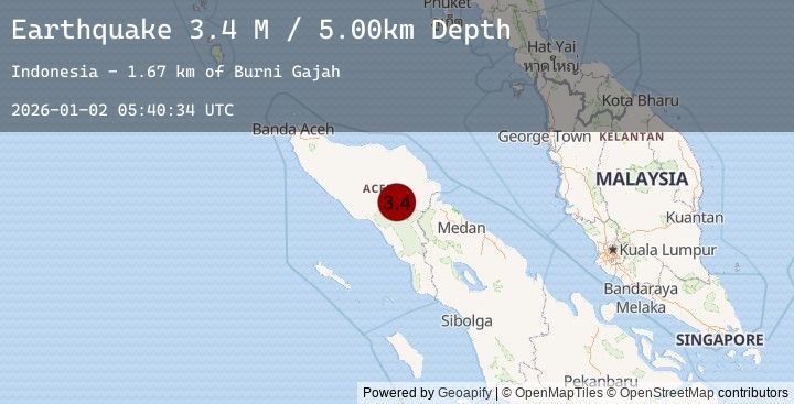
Earthquake Northern Sumatra, Indonesia
Fri, 02 Jan 2026 05:40:34 GMT
Time4 hours ago
Location
4.0971, 97.3913
Depth
5.0 KM
Event Summary
A 3.4 magnitude earthquake struck on Northern Sumatra, Indonesia, at Fri, 02 Jan 2026 05:40:34 GMT. Depth: 5km. Reviewed by BMKG seismologists, this minor quake occurred at a magnitude type of M.
Magnitude
3.4
M
Source
BMKG
Intensity
-
Agency Reports
1 Sources| Source | Magnitude | Depth | Time |
|---|---|---|---|
| BMKGPrimary | 3.4 | 5 km | 4 hours ago |
Earthquake Details
AutomaticEvent IDbmg2026acgt
Tsunami PotentialNo
Magnitude TypeM
Nearest Places
- Burni Gajah1.7 km
- Wai Tebing2.6 km
- Burni Kacang Minyak2.9 km
- Burni Kendawi3.8 km
- Gampong Gajah4.6 km
Comments
Join the discussion about this event.
Latest Earthquakes
1.4Mag
WESTERN TURKEY
Time5 hours ago
Depth5.50 km
SourceEMSC (Automatic)
2.5Mag
Bali Sea
Time5 hours ago
Depth6.61 km
SourceBMKG (Automatic)
2.8Mag
GREECE
Time5 hours ago
Depth12.10 km
SourceNOA (Automatic)
2.8Mag
STRAIT OF GIBRALTAR
Time5 hours ago
Depth32.00 km
SourceEMSC (Automatic)
1.2Mag
8 km SSE of Palomar Observatory, CA
Time5 hours ago
Depth13.50 km
SourceUSGS (Automatic)