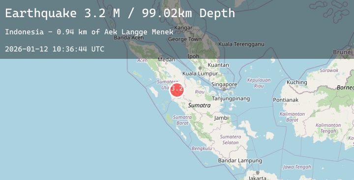
Earthquake Northern Sumatra, Indonesia
Mon, 12 Jan 2026 10:36:41 GMT
Time13 hours ago
Location
0.3475, 98.5095
Depth
53.0 KM
Event Summary
A 3.0 magnitude earthquake struck on Northern Sumatra, Indonesia, at Mon, 12 Jan 2026 10:36:41 GMT. Depth: 53.049789km. Reviewed by BMKG seismologists, this minor quake occurred at a magnitude type of M.
Magnitude
3.0
M
Source
BMKG
Intensity
-
Agency Reports
1 Sources| Source | Magnitude | Depth | Time |
|---|---|---|---|
| BMKGPrimary | 3.0 | 53 km | 13 hours ago |
Earthquake Details
AutomaticEvent IDbmg2026auxo
Tsunami PotentialNo
Magnitude TypeM
Nearest Places
- Tanjung Rapa-rapa21.4 km
- Lambak21.6 km
- Tanjung Batubatu21.9 km
- Tanjung Batubelobang23.1 km
- Desa Lambak24.4 km
Comments
Join the discussion about this event.
Latest Earthquakes
4.2Mag
OFF COAST OF NORTHERN PERU
Time13 hours ago
Depth41.00 km
SourceLIM (Automatic)
1.3Mag
WESTERN TURKEY
Time13 hours ago
Depth7.00 km
SourceAFAD (Automatic)
1.8Mag
9 km NNE of Banning, CA
Time13 hours ago
Depth18.03 km
SourceUSGS (Automatic)
3.5Mag
Southwest of Sumatra, Indonesia
Time13 hours ago
Depth27.24 km
SourceBMKG (Automatic)
1.5Mag
60 km S of Whites City, New Mexico
Time13 hours ago
Depth5.79 km
SourceUSGS (Automatic)