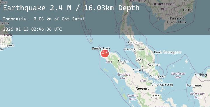
Earthquake Northern Sumatra, Indonesia
Tue, 13 Jan 2026 02:46:38 GMT
Time1 hour ago
Location
5.1015, 95.9033
Depth
3.8 KM
Event Summary
A 2.4 magnitude earthquake struck on Northern Sumatra, Indonesia, at Tue, 13 Jan 2026 02:46:38 GMT. Depth: 3.774117km. Reviewed by BMKG seismologists, this minor quake occurred at a magnitude type of M.
Magnitude
2.4
M
Source
BMKG
Intensity
-
Agency Reports
1 Sources| Source | Magnitude | Depth | Time |
|---|---|---|---|
| BMKGPrimary | 2.4 | 4 km | 1 hour ago |
Earthquake Details
AutomaticEvent IDbmg2026awdn
Tsunami PotentialNo
Magnitude TypeM
Nearest Places
- Alue Seupet0.7 km
- Blangmalue0.8 km
- Gle Blang Malo1.1 km
- Krueng Panteu1.1 km
- Blangdhot1.3 km
Comments
Join the discussion about this event.
Latest Earthquakes
2.0Mag
WESTERN TEXAS
Time1 hour ago
Depth4.10 km
SourceTX (Automatic)
2.7Mag
WESTERN AUSTRALIA
Time1 hour ago
Depth10.00 km
SourceAUST (Automatic)
3.3Mag
Minahassa Peninsula, Sulawesi
Time1 hour ago
Depth174.73 km
SourceBMKG (Automatic)
2.3Mag
64 km W of Nanwalek, Alaska
Time2 hours ago
Depth82.80 km
SourceUSGS (Automatic)
3.5Mag
TARAPACA, CHILE
Time2 hours ago
Depth108.70 km
SourceCSN (Automatic)