Earthquake Sumbawa Region, Indonesia
Fri, 16 Jan 2026 15:53:16 GMT
Time2 hours ago
Location
-9.5152, 116.8639
Depth
18.2 KM
Event Summary
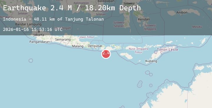
A 2.4 magnitude earthquake struck on Sumbawa Region, Indonesia, at Fri, 16 Jan 2026 15:53:16 GMT. Depth: 18.20236km. Reviewed by BMKG seismologists, this minor quake occurred at a magnitude type of M.
Magnitude
2.4
M
Source
BMKG
Intensity
-
Agency Reports
1 Sources| Source | Magnitude | Depth | Time |
|---|---|---|---|
| BMKGPrimary | 2.4 | 18 km | 2 hours ago |
Earthquake Details
AutomaticEvent IDbmg2026bcpz
Tsunami PotentialNo
Magnitude TypeM
Nearest Places
- Tanjung Talonan48.0 km
- Tanjung Moneh48.5 km
- Batu Lawang49.3 km
- Tanjung Tatar49.5 km
- Tanu Tanjunglilin50.0 km
Comments
Join the discussion about this event.
Latest Earthquakes
2.9Mag
Northern Molucca Sea
Time2 hours ago
Depth27.09 km
SourceBMKG (Automatic)
2.9Mag
Java, Indonesia
Time2 hours ago
Depth39.09 km
SourceBMKG (Automatic)
4.2Mag
HOKKAIDO, JAPAN REGION
Time2 hours ago
Depth0.00 km
SourceJMA (Automatic)
3.2Mag
Northern Molucca Sea
Time2 hours ago
Depth64.49 km
SourceBMKG (Automatic)
1.1Mag
4 km NNW of The Geysers, CA
Time2 hours ago
Depth2.58 km
SourceUSGS (Automatic)
Nearby Earthquakes
2.5Mag
Sumbawa Region, Indonesia
Time4 hours ago
Depth33.40 km
SourceBMKG (Automatic)
2.1Mag
Sumbawa Region, Indonesia
Time14 hours ago
Depth49.05 km
SourceBMKG (Automatic)
2.0Mag
Sumbawa Region, Indonesia
Time21 hours ago
Depth26.94 km
SourceBMKG (Automatic)
2.2Mag
Sumbawa Region, Indonesia
Time23 hours ago
Depth20.89 km
SourceBMKG (Automatic)