Earthquake Timor Region
Sat, 17 Jan 2026 01:38:24 GMT
Time4 hours ago
Location
-8.6844, 124.6182
Depth
10.0 KM
Event Summary
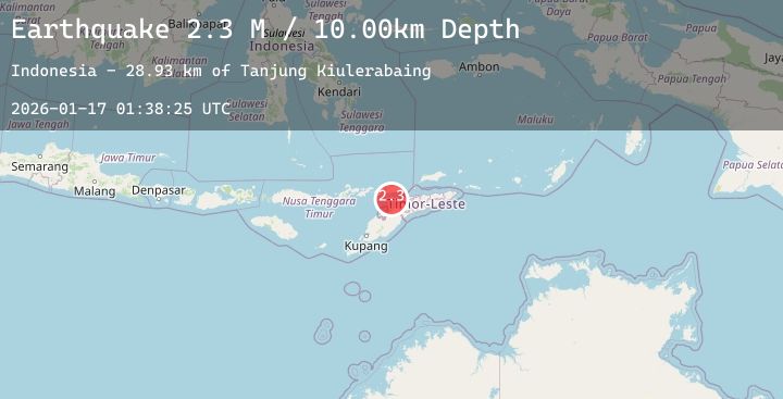
A 2.3 magnitude earthquake struck on Timor Region, at Sat, 17 Jan 2026 01:38:24 GMT. Depth: 10km. Reviewed by BMKG seismologists, this minor quake occurred at a magnitude type of M.
Magnitude
2.3
M
Source
BMKG
Intensity
-
Agency Reports
1 Sources| Source | Magnitude | Depth | Time |
|---|---|---|---|
| BMKGPrimary | 2.3 | 10 km | 4 hours ago |
Earthquake Details
AutomaticEvent IDbmg2026bdjh
Tsunami PotentialNo
Magnitude TypeM
Nearest Places
- Tanjung Kiulerabaing28.1 km
- Mol Serba28.2 km
- Tanjung Sifala28.3 km
- Kuilerabaing28.3 km
- Mol Baringbur28.3 km
Comments
Join the discussion about this event.
Latest Earthquakes
3.1Mag
Sulawesi, Indonesia
Time4 hours ago
Depth5.00 km
SourceBMKG (Automatic)
3.8Mag
South of Java, Indonesia
Time4 hours ago
Depth10.00 km
SourceBMKG (Automatic)
2.1Mag
CENTRAL ITALY
Time4 hours ago
Depth7.50 km
SourceINGV (Automatic)
3.1Mag
Southern Sumatra, Indonesia
Time4 hours ago
Depth9.92 km
SourceBMKG (Automatic)
1.3Mag
CENTRAL TURKEY
Time4 hours ago
Depth7.30 km
SourceAFAD (Automatic)