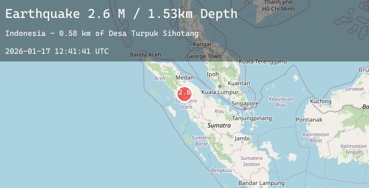
Earthquake Northern Sumatra, Indonesia
Sat, 17 Jan 2026 12:41:40 GMT
Time2 hours ago
Location
2.5582, 98.6739
Depth
3.0 KM
Event Summary
A 2.4 magnitude earthquake struck on Northern Sumatra, Indonesia, at Sat, 17 Jan 2026 12:41:40 GMT. Depth: 3km. Reviewed by BMKG seismologists, this minor quake occurred at a magnitude type of M.
Magnitude
2.4
M
Source
BMKG
Intensity
-
Agency Reports
1 Sources| Source | Magnitude | Depth | Time |
|---|---|---|---|
| BMKGPrimary | 2.4 | 3 km | 2 hours ago |
Earthquake Details
AutomaticEvent IDbmg2026befe
Tsunami PotentialNo
Magnitude TypeM
Nearest Places
- Onanrihit1.1 km
- Binangan Harian1.2 km
- Pagarbotak1.2 km
- Bea1.2 km
- Simannampang1.3 km
Comments
Join the discussion about this event.
Latest Earthquakes
4.1Mag
SOUTHWESTERN RYUKYU ISL., JAPAN
Time2 hours ago
Depth20.00 km
SourceJMA (Automatic)
1.8Mag
126 km SSE of McCarthy, Alaska
Time2 hours ago
Depth6.10 km
SourceUSGS (Automatic)
2.1Mag
58 km SSE of King Salmon, Alaska
Time2 hours ago
Depth7.50 km
SourceUSGS (Automatic)
2.5Mag
South of Bali, Indonesia
Time2 hours ago
Depth31.57 km
SourceBMKG (Automatic)
3.1Mag
ANTOFAGASTA, CHILE
Time2 hours ago
Depth133.20 km
SourceCSN (Automatic)