Earthquake Sunda Strait, Indonesia
Sat, 17 Jan 2026 22:40:37 GMT
Time2 hours ago
Location
-6.0352, 104.8826
Depth
63.3 KM
Event Summary
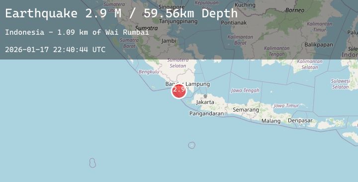
A 3.4 magnitude earthquake struck on Sunda Strait, Indonesia, at Sat, 17 Jan 2026 22:40:37 GMT. Depth: 63.276127km. Reviewed by BMKG seismologists, this minor quake occurred at a magnitude type of M.
Magnitude
3.4
M
Source
BMKG
Intensity
-
Agency Reports
1 Sources| Source | Magnitude | Depth | Time |
|---|---|---|---|
| BMKGPrimary | 3.4 | 63 km | 2 hours ago |
Earthquake Details
AutomaticEvent IDbmg2026beyz
Tsunami PotentialNo
Magnitude TypeM
Nearest Places
- Cukuredak Seamount17.9 km
- Tanjung Cina20.3 km
- Batu Kebucung21.3 km
- Gunung Sawangcemerlang21.7 km
- Teluk Khaddak22.0 km
Comments
Join the discussion about this event.
Latest Earthquakes
1.8Mag
6 km SW of Volcano, Hawaii
Time1 hour ago
Depth1.61 km
SourceUSGS (Automatic)
1.6Mag
10 km W of Houston, Alaska
Time1 hour ago
Depth29.10 km
SourceUSGS (Automatic)
1.5Mag
7 km NE of Coso Junction, CA
Time1 hour ago
Depth5.55 km
SourceUSGS (Automatic)
2.0Mag
PUERTO RICO REGION
Time1 hour ago
Depth12.70 km
SourcePR (Automatic)
1.6Mag
14 km SSW of Mentone, Texas
Time2 hours ago
Depth0.00 km
SourceUSGS (Automatic)