Earthquake Minahassa Peninsula, Sulawesi
Thu, 22 Jan 2026 16:35:55 GMT
Time4 days ago
Location
-0.1606, 122.5631
Depth
37.3 KM
Event Summary
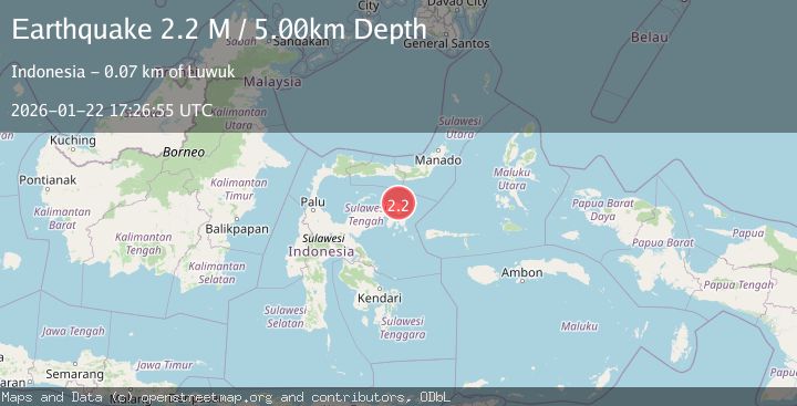
A 2.2 magnitude earthquake struck on Minahassa Peninsula, Sulawesi, at Thu, 22 Jan 2026 16:35:55 GMT. Depth: 37.340061km. Reviewed by BMKG seismologists, this minor quake occurred at a magnitude type of M.
Magnitude
2.2
M
Source
BMKG
Intensity
-
Agency Reports
1 Sources| Source | Magnitude | Depth | Time |
|---|---|---|---|
| BMKGPrimary | 2.2 | 5 km | 4 days ago |
Earthquake Details
AutomaticEvent IDbmg2026bnqk
Tsunami PotentialNo
Magnitude TypeM
Nearest Places
- Karang Buniak22.8 km
- Tanjung Polumpung24.0 km
- Karang Bokoboko24.1 km
- Pongidan25.1 km
- Kaunyo Pongidan25.1 km
Comments
Join the discussion about this event.
Latest Earthquakes
1.1Mag
30 km NE of Los Alamos, CA
Time11 minutes ago
Depth4.17 km
SourceUSGS (Automatic)
1.2Mag
EASTERN TURKEY
Time11 minutes ago
Depth7.00 km
SourceAFAD (Automatic)
2.6Mag
Timor Region
Time14 minutes ago
Depth35.26 km
SourceBMKG (Automatic)
2.3Mag
Sumbawa Region, Indonesia
Time14 minutes ago
Depth10.00 km
SourceBMKG (Automatic)
2.5Mag
Flores Sea
Time15 minutes ago
Depth26.93 km
SourceBMKG (Automatic)
Nearby Earthquakes
5.1Mag
84 km N of Luwuk, Indonesia
Time5 days ago
Depth92.62 km
SourceUSGS
2.6Mag
Minahassa Peninsula, Sulawesi
Time2 days ago
Depth59.44 km
SourceBMKG (Automatic)
2.6Mag
Minahassa Peninsula, Sulawesi
Time3 days ago
Depth124.69 km
SourceBMKG (Automatic)
2.3Mag
Minahassa Peninsula, Sulawesi
Time5 days ago
Depth154.22 km
SourceBMKG (Automatic)
3.9Mag
Minahassa Peninsula, Sulawesi
Time5 days ago
Depth29.89 km
SourceBMKG (Automatic)