Earthquake Northern Molucca Sea
Sat, 24 Jan 2026 15:25:37 GMT
Time2 days ago
Location
1.2955, 126.8942
Depth
61.2 KM
Event Summary
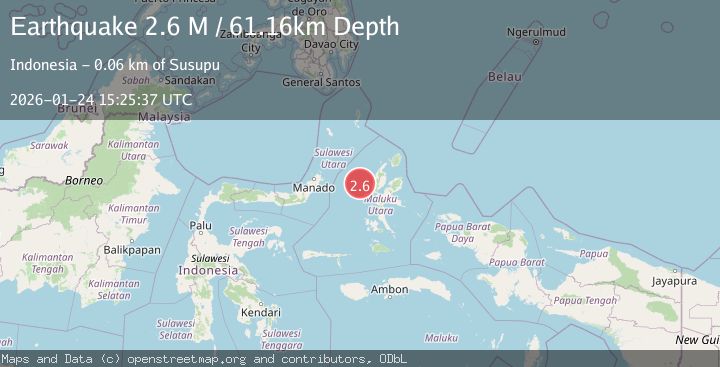
A 2.6 magnitude earthquake struck on Northern Molucca Sea, at Sat, 24 Jan 2026 15:25:37 GMT. Depth: 61.156181km. Reviewed by BMKG seismologists, this minor quake occurred at a magnitude type of M.
Magnitude
2.6
M
Source
BMKG
Intensity
-
Agency Reports
1 Sources| Source | Magnitude | Depth | Time |
|---|---|---|---|
| BMKGPrimary | 2.6 | 61 km | 2 days ago |
Earthquake Details
AutomaticEvent IDbmg2026brfc
Tsunami PotentialNo
Magnitude TypeM
Nearest Places
- Nyi32.4 km
- Kelurahan Bido54.9 km
- Pulau Mayu56.5 km
- Kecamatan Pulau Batang Dua56.6 km
- Kelurahan Lelewi56.8 km
Comments
Join the discussion about this event.
Latest Earthquakes
2.1Mag
WESTERN TEXAS
Time19 minutes ago
Depth4.40 km
SourceTX (Automatic)
1.3Mag
20 km ENE of Little Lake, CA
Time20 minutes ago
Depth1.84 km
SourceUSGS (Automatic)
2.9Mag
South of Java, Indonesia
Time27 minutes ago
Depth3.21 km
SourceBMKG (Automatic)
2.0Mag
WESTERN TURKEY
Time28 minutes ago
Depth6.70 km
SourceAFAD (Automatic)
2.1Mag
6 km NNW of The Geysers, CA
Time38 minutes ago
Depth2.52 km
SourceUSGS (Automatic)
Nearby Earthquakes
3.8Mag
Northern Molucca Sea
Time5 hours ago
Depth106.66 km
SourceBMKG (Automatic)
3.1Mag
Northern Molucca Sea
Time3 hours ago
Depth31.63 km
SourceBMKG (Automatic)
4.7Mag
Northern Molucca Sea
Time5 days ago
Depth23.34 km
SourceBMKG (Automatic)
3.1Mag
Northern Molucca Sea
Time2 days ago
Depth27.94 km
SourceBMKG (Automatic)
3.0Mag
Northern Molucca Sea
Time1 day ago
Depth25.04 km
SourceBMKG (Automatic)