Earthquake Southern Molucca Sea
Sat, 24 Jan 2026 17:28:51 GMT
Time3 days ago
Location
-0.1753, 124.4986
Depth
12.0 KM
Event Summary
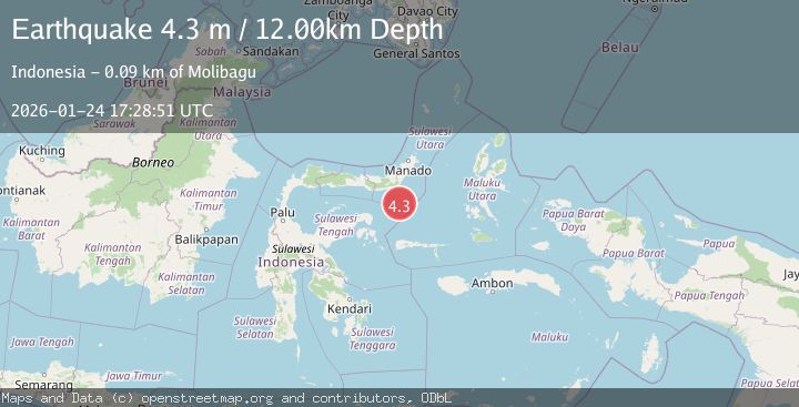
A 4.3 magnitude earthquake struck on Southern Molucca Sea, at Sat, 24 Jan 2026 17:28:51 GMT. Depth: 11.965501km. Reviewed by BMKG seismologists, this light quake occurred at a magnitude type of M.
Magnitude
4.3
M
Source
BMKG
Intensity
-
Agency Reports
1 Sources| Source | Magnitude | Depth | Time |
|---|---|---|---|
| BMKGPrimary | 4.3 | 12 km | 3 days ago |
Earthquake Details
AutomaticEvent IDbmg2026brjf
Tsunami PotentialNo
Magnitude TypeM
Nearest Places
- Gorontalo Basin56.1 km
- Libuton Pondanmointok68.0 km
- Pulau-pulau Batutolu68.2 km
- Impoda Bulu68.3 km
- Tanjung Bokka68.4 km
Comments
Join the discussion about this event.
Latest Earthquakes
1.7Mag
42 km NW of Toyah, Texas
Time2 minutes ago
Depth4.72 km
SourceUSGS (Automatic)
4.8Mag
Mindanao, Philippines
Time9 minutes ago
Depth10.00 km
SourceBMKG (Automatic)
2.8Mag
CRETE, GREECE
Time13 minutes ago
Depth6.80 km
SourceNOA (Automatic)
0.9Mag
6 km NW of The Geysers, CA
Time19 minutes ago
Depth2.53 km
SourceUSGS (Automatic)
4.5Mag
South of Java, Indonesia
Time23 minutes ago
Depth10.00 km
SourceBMKG (Automatic)
Nearby Earthquakes
4.3Mag
Southern Molucca Sea
Time5 days ago
Depth5.64 km
SourceBMKG (Automatic)
3.0Mag
MOLUCCA SEA
Time4 days ago
Depth9.00 km
SourceBMKG (Automatic)
2.9Mag
MINAHASA, SULAWESI, INDONESIA
Time4 days ago
Depth18.00 km
SourceBMKG (Automatic)
3.0Mag
Minahassa Peninsula, Sulawesi
Time3 days ago
Depth55.68 km
SourceBMKG (Automatic)
3.9Mag
Minahassa Peninsula, Sulawesi
Time16 hours ago
Depth203.73 km
SourceBMKG (Automatic)