Earthquake 42 km NW of Toyah, Texas
Tue, 27 Jan 2026 23:26:48 GMT
Time1 hour ago
Location
31.5370, -104.1590
Depth
4.7 KM
Event Summary
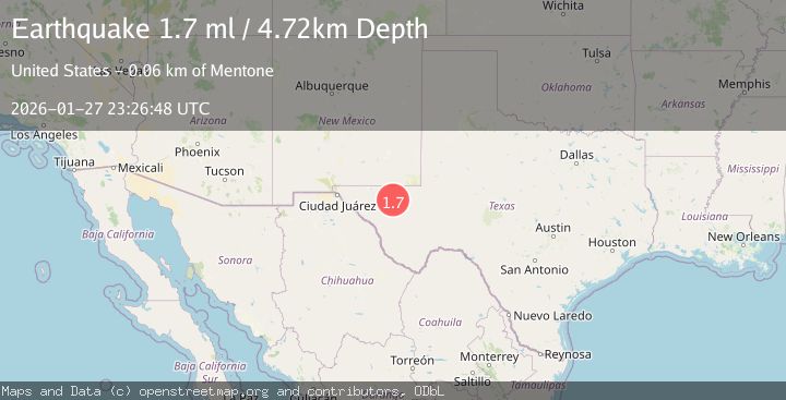
A 1.7 magnitude earthquake struck on 42 km NW of Toyah, Texas, at Tue, 27 Jan 2026 23:26:48 GMT. Depth: 4.7204km. Reviewed by USGS seismologists, this minor quake occurred at a magnitude type of ml.
Magnitude
1.7
ml
Source
USGS
Intensity
-
Agency Reports
1 Sources| Source | Magnitude | Depth | Time |
|---|---|---|---|
| USGSPrimary | 1.7 | 5 km | 1 hour ago |
Earthquake Details
AutomaticEvent IDusgs_tx2026bxnnex
Tsunami PotentialNo
Magnitude Typeml
Nearest Places
- Brooks Ranch2.0 km
- Two Mill Draw2.5 km
- Big Canyon Draw2.8 km
- Gulf Windmill4.6 km
- Orchard Windmill7.6 km
Comments
Join the discussion about this event.
Latest Earthquakes
2.8Mag
63 km SE of Denali National Park, Alaska
Time7 minutes ago
Depth123.60 km
SourceUSGS (Automatic)
3.9Mag
West Papua Region, Indonesia
Time9 minutes ago
Depth17.51 km
SourceBMKG (Automatic)
1.5Mag
6 km W of Holtville, CA
Time10 minutes ago
Depth8.56 km
SourceUSGS (Automatic)
1.6Mag
2 km NW of The Geysers, CA
Time10 minutes ago
Depth1.46 km
SourceUSGS (Automatic)
2.3Mag
Flores Region, Indonesia
Time12 minutes ago
Depth105.89 km
SourceBMKG (Automatic)
Nearby Earthquakes
1.4Mag
41 km NW of Toyah, Texas
Time11 hours ago
Depth2.74 km
SourceUSGS (Automatic)
1.5Mag
40 km WNW of Toyah, Texas
Time3 days ago
Depth4.04 km
SourceUSGS (Automatic)
1.7Mag
44 km NW of Toyah, Texas
Time3 days ago
Depth4.27 km
SourceUSGS (Automatic)
1.5Mag
36 km NW of Toyah, Texas
Time2 days ago
Depth5.77 km
SourceUSGS (Automatic)
1.5Mag
37 km NW of Toyah, Texas
Time5 days ago
Depth6.63 km
SourceUSGS (Automatic)