Earthquake West Papua Region, Indonesia
Sun, 25 Jan 2026 23:04:29 GMT
Time1 day ago
Location
-2.8491, 134.3101
Depth
10.7 KM
Event Summary
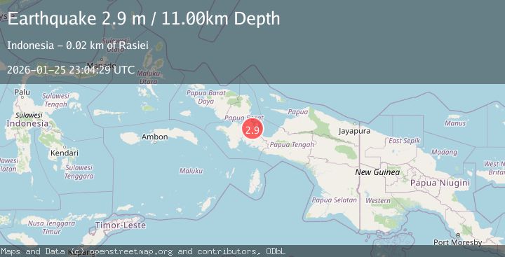
A 2.9 magnitude earthquake struck on West Papua Region, Indonesia, at Sun, 25 Jan 2026 23:04:29 GMT. Depth: 10.683231km. Reviewed by BMKG seismologists, this minor quake occurred at a magnitude type of M.
Magnitude
2.9
M
Source
BMKG
Intensity
-
Agency Reports
1 Sources| Source | Magnitude | Depth | Time |
|---|---|---|---|
| BMKGPrimary | 2.9 | 11 km | 1 day ago |
Earthquake Details
AutomaticEvent IDbmg2026btpt
Tsunami PotentialNo
Magnitude TypeM
Nearest Places
- Gunung Memokessiware1.7 km
- Koke7.6 km
- Distrik Kuri Wamesa8.0 km
- Kampung Nanimori8.6 km
- Kampung Ambumi9.5 km
Comments
Join the discussion about this event.
Latest Earthquakes
2.0Mag
Sumbawa Region, Indonesia
Time6 minutes ago
Depth107.77 km
SourceBMKG (Automatic)
1.7Mag
26 km WNW of Ludlow, CA
Time10 minutes ago
Depth1.36 km
SourceUSGS (Automatic)
3.1Mag
HAITI REGION
Time13 minutes ago
Depth7.00 km
SourceAYIT (Automatic)
2.6Mag
PUERTO RICO
Time19 minutes ago
Depth16.10 km
SourcePR (Automatic)
2.1Mag
WESTERN TEXAS
Time30 minutes ago
Depth4.40 km
SourceTX (Automatic)
Nearby Earthquakes
3.3Mag
West Papua Region, Indonesia
Time4 days ago
Depth10.00 km
SourceBMKG (Automatic)
3.6Mag
West Papua Region, Indonesia
Time4 days ago
Depth10.00 km
SourceBMKG (Automatic)
2.3Mag
West Papua Region, Indonesia
Time2 days ago
Depth40.13 km
SourceBMKG (Automatic)
2.7Mag
West Papua Region, Indonesia
Time3 days ago
Depth35.26 km
SourceBMKG (Automatic)
3.2Mag
West Papua Region, Indonesia
Time6 days ago
Depth10.00 km
SourceBMKG (Automatic)