Earthquake Timor Region
Mon, 26 Jan 2026 15:00:14 GMT
Time19 hours ago
Location
-9.0439, 124.0107
Depth
37.1 KM
Event Summary
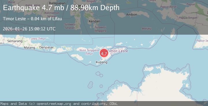
A 4.2 magnitude earthquake struck on Timor Region, at Mon, 26 Jan 2026 15:00:14 GMT. Depth: 37.136768km. Reviewed by BMKG seismologists, this light quake occurred at a magnitude type of M.
Magnitude
4.2
M
Source
BMKG
Intensity
-
Agency Reports
1 Sources| Source | Magnitude | Depth | Time |
|---|---|---|---|
| BMKGPrimary | 4.2 | 37 km | 19 hours ago |
Earthquake Details
AutomaticEvent IDbmg2026buvh
Tsunami PotentialNo
Magnitude TypeM
Nearest Places
- Pulau Batek24.9 km
- Point Panamtasa30.0 km
- River Oenis30.1 km
- River Namun30.6 km
- River Niutmieo30.8 km
Comments
Join the discussion about this event.
Latest Earthquakes
2.2Mag
Ceram Sea
Time19 hours ago
Depth10.00 km
SourceBMKG (Automatic)
2.9Mag
Talaud Islands, Indonesia
Time19 hours ago
Depth39.53 km
SourceBMKG (Automatic)
1.8Mag
9 km ESE of Puebla, B.C., MX
Time19 hours ago
Depth18.70 km
SourceUSGS (Automatic)
2.1Mag
Java, Indonesia
Time19 hours ago
Depth17.76 km
SourceBMKG (Automatic)
5.3Mag
KURIL ISLANDS
Time19 hours ago
Depth53.00 km
SourceEMSC (Automatic)
Nearby Earthquakes
2.5Mag
Flores Region, Indonesia
Time5 days ago
Depth51.05 km
SourceBMKG (Automatic)
3.2Mag
Flores Region, Indonesia
Time6 days ago
Depth82.44 km
SourceBMKG (Automatic)
2.7Mag
Flores Region, Indonesia
Time22 hours ago
Depth6.99 km
SourceBMKG (Automatic)
3.3Mag
Timor Region
Time1 day ago
Depth47.49 km
SourceBMKG (Automatic)
2.6Mag
Timor Region
Time2 days ago
Depth83.16 km
SourceBMKG (Automatic)