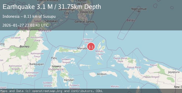
Earthquake Northern Molucca Sea
Tue, 27 Jan 2026 23:03:43 GMT
Time3 hours ago
Location
1.4498, 126.3201
Depth
31.7 KM
Event Summary
A 2.9 magnitude earthquake struck on Northern Molucca Sea, at Tue, 27 Jan 2026 23:03:43 GMT. Depth: 31.748539km. Reviewed by BMKG seismologists, this minor quake occurred at a magnitude type of M.
Magnitude
2.9
M
Source
BMKG
Intensity
-
Agency Reports
1 Sources| Source | Magnitude | Depth | Time |
|---|---|---|---|
| BMKGPrimary | 2.9 | 32 km | 3 hours ago |
Earthquake Details
AutomaticEvent IDbmg2026bxgs
Tsunami PotentialNo
Magnitude TypeM
Nearest Places
- Kelurahan Mayau14.2 km
- Kelurahan Perum Bersatu14.3 km
- Pasirputih14.8 km
- Pulau Mayu15.7 km
- Kecamatan Pulau Batang Dua15.8 km
Comments
Join the discussion about this event.
Latest Earthquakes
2.3Mag
SPAIN
Time3 hours ago
Depth6.00 km
SourceEMSC (Automatic)
3.1Mag
SOUTHERN ALASKA
Time4 hours ago
Depth38.80 km
SourceAK (Automatic)
3.3Mag
KYUSHU, JAPAN
Time4 hours ago
Depth20.00 km
SourceJMA (Automatic)
2.6Mag
OREGON
Time4 hours ago
Depth-0.60 km
SourceUW (Automatic)
1.2Mag
WESTERN TURKEY
Time4 hours ago
Depth6.20 km
SourceAFAD (Automatic)
Nearby Earthquakes
3.1Mag
Northern Molucca Sea
Time16 hours ago
Depth31.63 km
SourceBMKG (Automatic)
4.7Mag
Northern Molucca Sea
Time5 days ago
Depth23.34 km
SourceBMKG (Automatic)
3.0Mag
Northern Molucca Sea
Time2 days ago
Depth25.04 km
SourceBMKG (Automatic)
3.1Mag
Northern Molucca Sea
Time2 days ago
Depth27.94 km
SourceBMKG (Automatic)
2.6Mag
Northern Molucca Sea
Time3 days ago
Depth61.16 km
SourceBMKG (Automatic)