Earthquake Northern Molucca Sea
Wed, 28 Jan 2026 15:01:27 GMT
Time3 hours ago
Location
1.6029, 125.9986
Depth
30.8 KM
Event Summary
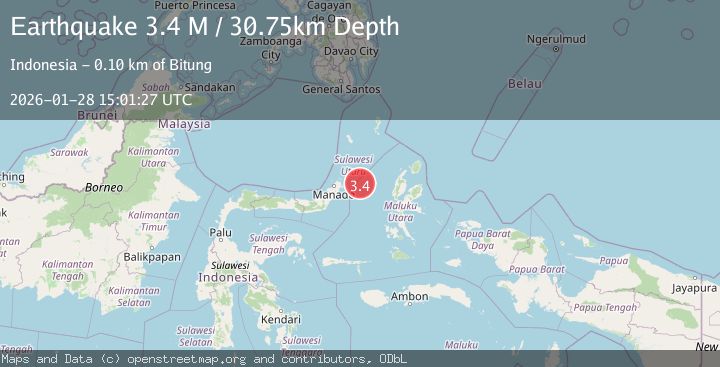
A 3.4 magnitude earthquake struck on Northern Molucca Sea, at Wed, 28 Jan 2026 15:01:27 GMT. Depth: 30.752293km. Reviewed by BMKG seismologists, this minor quake occurred at a magnitude type of M.
Magnitude
3.4
M
Source
BMKG
Intensity
-
Agency Reports
1 Sources| Source | Magnitude | Depth | Time |
|---|---|---|---|
| BMKGPrimary | 3.4 | 31 km | 3 hours ago |
Earthquake Details
AutomaticEvent IDbmg2026bymi
Tsunami PotentialNo
Magnitude TypeM
Nearest Places
- Kelurahan Perum Bersatu50.4 km
- Pasirputih50.9 km
- Kelurahan Mayau51.4 km
- Pulau Mayu53.0 km
- Kecamatan Pulau Batang Dua53.1 km
Comments
Join the discussion about this event.
Latest Earthquakes
2.3Mag
Sumba Region, Indonesia
Time3 hours ago
Depth41.02 km
SourceBMKG (Automatic)
2.7Mag
SAN JUAN, ARGENTINA
Time3 hours ago
Depth74.00 km
SourceNSNA (Automatic)
1.6Mag
11 km W of Stanton, Texas
Time3 hours ago
Depth3.82 km
SourceUSGS (Automatic)
3.3Mag
Celebes Sea
Time3 hours ago
Depth9.81 km
SourceBMKG (Automatic)
2.6Mag
AEGEAN SEA
Time4 hours ago
Depth14.40 km
SourceEMSC (Automatic)
Nearby Earthquakes
3.1Mag
Northern Molucca Sea
Time19 hours ago
Depth31.75 km
SourceBMKG (Automatic)
2.8Mag
Northern Molucca Sea
Time5 hours ago
Depth6.77 km
SourceBMKG (Automatic)
3.1Mag
Northern Molucca Sea
Time1 day ago
Depth31.63 km
SourceBMKG (Automatic)
4.7Mag
Northern Molucca Sea
Time6 days ago
Depth23.34 km
SourceBMKG (Automatic)
3.0Mag
Northern Molucca Sea
Time2 days ago
Depth25.04 km
SourceBMKG (Automatic)