Earthquake Northern Molucca Sea
Fri, 30 Jan 2026 14:49:20 GMT
Time3 hours ago
Location
0.8472, 126.2259
Depth
61.0 KM
Event Summary
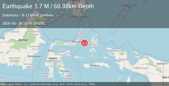
A 3.7 magnitude earthquake struck on Northern Molucca Sea, at Fri, 30 Jan 2026 14:49:20 GMT. Depth: 60.97575km. Reviewed by BMKG seismologists, this minor quake occurred at a magnitude type of M.
Magnitude
3.7
M
Source
BMKG
Intensity
-
Agency Reports
1 Sources| Source | Magnitude | Depth | Time |
|---|---|---|---|
| BMKGPrimary | 3.7 | 61 km | 3 hours ago |
Earthquake Details
AutomaticEvent IDbmg2026cccy
Tsunami PotentialNo
Magnitude TypeM
Nearest Places
- Kelurahan Tifure16.2 km
- Pulau Tifore16.9 km
- Kelurahan Pantai Sagu17.6 km
- Pulau Gureda17.8 km
- Maluku Sea46.1 km
Comments
Join the discussion about this event.
Latest Earthquakes
3.6Mag
OFF W. COAST OF N. ISLAND, N.Z.
Time3 hours ago
Depth12.00 km
SourceGNS (Automatic)
2.6Mag
CENTRAL TURKEY
Time3 hours ago
Depth4.90 km
SourceKOERI (Automatic)
2.1Mag
WESTERN TURKEY
Time3 hours ago
Depth8.60 km
SourceAFAD (Automatic)
3.3Mag
Minahassa Peninsula, Sulawesi
Time3 hours ago
Depth10.00 km
SourceBMKG (Automatic)
1.5Mag
10 km W of Forsan, Texas
Time3 hours ago
Depth4.32 km
SourceUSGS (Automatic)
Nearby Earthquakes
3.6Mag
Northern Molucca Sea
Time14 hours ago
Depth10.00 km
SourceBMKG (Automatic)
3.0Mag
Northern Molucca Sea
Time4 days ago
Depth25.04 km
SourceBMKG (Automatic)
3.1Mag
Northern Molucca Sea
Time5 days ago
Depth27.94 km
SourceBMKG (Automatic)
3.1Mag
Northern Molucca Sea
Time1 day ago
Depth14.98 km
SourceBMKG (Automatic)
4.7Mag
Northern Molucca Sea
Time1 week ago
Depth23.34 km
SourceBMKG (Automatic)