Earthquake West Papua, Indonesia
Fri, 30 Jan 2026 20:02:01 GMT
Time1 hour ago
Location
-3.0615, 140.0703
Depth
65.3 KM
Event Summary
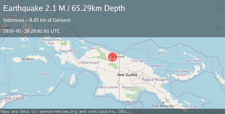
A 2.1 magnitude earthquake struck on West Papua, Indonesia, at Fri, 30 Jan 2026 20:02:01 GMT. Depth: 65.293846km. Reviewed by BMKG seismologists, this minor quake occurred at a magnitude type of M.
Magnitude
2.1
M
Source
BMKG
Intensity
-
Agency Reports
1 Sources| Source | Magnitude | Depth | Time |
|---|---|---|---|
| BMKGPrimary | 2.1 | 65 km | 1 hour ago |
Earthquake Details
AutomaticEvent IDbmg2026ccng
Tsunami PotentialNo
Magnitude TypeM
Nearest Places
- Kabupaten Jayapura13.0 km
- Sengbo14.9 km
- Tara15.0 km
- Kampung Yadauw15.9 km
- Lereh Airport15.9 km
Comments
Join the discussion about this event.
Latest Earthquakes
2.2Mag
Sunda Strait, Indonesia
Time1 hour ago
Depth6.74 km
SourceBMKG (Automatic)
3.0Mag
Minahassa Peninsula, Sulawesi
Time1 hour ago
Depth10.00 km
SourceBMKG (Automatic)
1.6Mag
14 km WSW of Mojave, CA
Time1 hour ago
Depth7.99 km
SourceUSGS (Automatic)
2.0Mag
Java, Indonesia
Time1 hour ago
Depth13.22 km
SourceBMKG (Automatic)
1.7Mag
5 km N of Dublin, CA
Time1 hour ago
Depth7.61 km
SourceUSGS (Automatic)
Nearby Earthquakes
2.9Mag
West Papua, Indonesia
Time1 day ago
Depth42.09 km
SourceBMKG (Automatic)
2.4Mag
Near North Coast of West Papua
Time5 days ago
Depth10.00 km
SourceBMKG (Automatic)
2.9Mag
Near North Coast of West Papua
Time2 days ago
Depth25.99 km
SourceBMKG (Automatic)
2.5Mag
West Papua, Indonesia
Time1 week ago
Depth10.00 km
SourceBMKG (Automatic)
2.6Mag
West Papua, Indonesia
Time6 days ago
Depth22.39 km
SourceBMKG (Automatic)