Earthquake Northern Sumatra, Indonesia
Fri, 30 Jan 2026 21:09:54 GMT
Time1 hour ago
Location
4.1847, 97.4535
Depth
13.0 KM
Event Summary
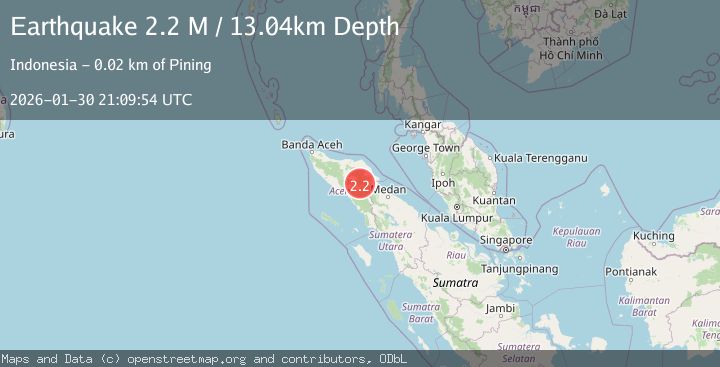
A 2.2 magnitude earthquake struck on Northern Sumatra, Indonesia, at Fri, 30 Jan 2026 21:09:54 GMT. Depth: 13.040854km. Reviewed by BMKG seismologists, this minor quake occurred at a magnitude type of M.
Magnitude
2.2
M
Source
BMKG
Intensity
-
Agency Reports
1 Sources| Source | Magnitude | Depth | Time |
|---|---|---|---|
| BMKGPrimary | 2.2 | 13 km | 1 hour ago |
Earthquake Details
AutomaticEvent IDbmg2026ccpn
Tsunami PotentialNo
Magnitude TypeM
Nearest Places
- Gunung Aber1.3 km
- Gunung Lojang1.9 km
- Gunung Gemiring3.2 km
- Arul Pepelah3.3 km
- Gunung Lembu4.6 km
Comments
Join the discussion about this event.
Latest Earthquakes
2.9Mag
South of Java, Indonesia
Time2 hours ago
Depth18.00 km
SourceBMKG (Automatic)
2.4Mag
3 km NW of The Geysers, CA
Time2 hours ago
Depth2.84 km
SourceUSGS (Automatic)
2.5Mag
WESTERN TURKEY
Time2 hours ago
Depth14.50 km
SourceKOERI (Automatic)
3.6Mag
MYANMAR-INDIA BORDER REGION
Time2 hours ago
Depth80.00 km
SourceNDI (Automatic)
2.4Mag
NEW JERSEY
Time2 hours ago
Depth8.90 km
SourceNEIC (Automatic)
Nearby Earthquakes
2.4Mag
Northern Sumatra, Indonesia
Time5 days ago
Depth5.00 km
SourceBMKG (Automatic)
2.2Mag
Northern Sumatra, Indonesia
Time22 hours ago
Depth10.00 km
SourceBMKG (Automatic)
2.2Mag
Northern Sumatra, Indonesia
Time1 week ago
Depth1.65 km
SourceBMKG (Automatic)
2.6Mag
Northern Sumatra, Indonesia
Time1 day ago
Depth5.00 km
SourceBMKG (Automatic)
2.4Mag
Northern Sumatra, Indonesia
Time3 days ago
Depth1.40 km
SourceBMKG (Automatic)