Earthquake West Papua, Indonesia
Sat, 31 Jan 2026 05:40:52 GMT
Time4 hours ago
Location
-3.8544, 140.0808
Depth
138.5 KM
Event Summary
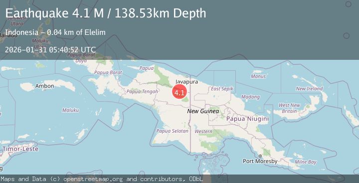
A 4.1 magnitude earthquake struck on West Papua, Indonesia, at Sat, 31 Jan 2026 05:40:52 GMT. Depth: 138.531631km. Reviewed by BMKG seismologists, this light quake occurred at a magnitude type of M.
Magnitude
4.1
M
Source
BMKG
Intensity
-
Agency Reports
1 Sources| Source | Magnitude | Depth | Time |
|---|---|---|---|
| BMKGPrimary | 4.1 | 139 km | 4 hours ago |
Earthquake Details
AutomaticEvent IDbmg2026cdgj
Tsunami PotentialNo
Magnitude TypeM
Nearest Places
- Kampung Paleromon1.0 km
- Elelim Indonesia4.5 km
- Kampung Lulum13.0 km
- Distrik Batani16.9 km
- Distrik Talambo17.0 km
Comments
Join the discussion about this event.
Latest Earthquakes
3.0Mag
Minahassa Peninsula, Sulawesi
Time4 hours ago
Depth4.37 km
SourceBMKG (Automatic)
1.5Mag
7 km WNW of Cobb, CA
Time5 hours ago
Depth2.13 km
SourceUSGS (Automatic)
1.0Mag
EASTERN TURKEY
Time5 hours ago
Depth7.00 km
SourceAFAD (Automatic)
2.5Mag
Sumbawa Region, Indonesia
Time5 hours ago
Depth16.65 km
SourceBMKG (Automatic)
2.4Mag
LASSEN PEAK AREA, CALIFORNIA
Time5 hours ago
Depth0.60 km
SourceNC (Automatic)
Nearby Earthquakes
2.8Mag
West Papua, Indonesia
Time1 week ago
Depth10.00 km
SourceBMKG (Automatic)
2.6Mag
West Papua, Indonesia
Time1 week ago
Depth61.18 km
SourceBMKG (Automatic)
2.8Mag
PAPUA, INDONESIA
Time1 day ago
Depth10.00 km
SourceBMKG (Automatic)
2.2Mag
West Papua, Indonesia
Time15 hours ago
Depth99.11 km
SourceBMKG (Automatic)
2.9Mag
West Papua, Indonesia
Time2 days ago
Depth18.29 km
SourceBMKG (Automatic)