Earthquake West Papua, Indonesia
Fri, 30 Jan 2026 18:51:09 GMT
Time3 hours ago
Location
-3.4902, 140.3079
Depth
99.1 KM
Event Summary
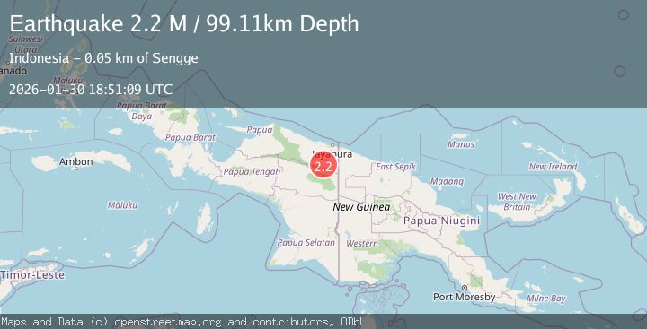
A 2.2 magnitude earthquake struck on West Papua, Indonesia, at Fri, 30 Jan 2026 18:51:09 GMT. Depth: 99.108604km. Reviewed by BMKG seismologists, this minor quake occurred at a magnitude type of M.
Magnitude
2.2
M
Source
BMKG
Intensity
-
Agency Reports
1 Sources| Source | Magnitude | Depth | Time |
|---|---|---|---|
| BMKGPrimary | 2.2 | 99 km | 3 hours ago |
Earthquake Details
AutomaticEvent IDbmg2026cckx
Tsunami PotentialNo
Magnitude TypeM
Nearest Places
- Kampung Aurina4.8 km
- Kiveh9.6 km
- Keerom River10.5 km
- Pauwasi10.6 km
- Songgolo14.3 km
Comments
Join the discussion about this event.
Latest Earthquakes
3.5Mag
Talaud Islands, Indonesia
Time3 hours ago
Depth10.00 km
SourceBMKG (Automatic)
3.4Mag
SAN FRANCISCO BAY AREA, CALIF.
Time3 hours ago
Depth6.70 km
SourceNC (Automatic)
2.9Mag
CRETE, GREECE
Time3 hours ago
Depth17.30 km
SourceNOA (Automatic)
3.9Mag
PHILIPPINE ISLANDS REGION
Time3 hours ago
Depth4.00 km
SourcePIVS (Automatic)
1.3Mag
5 km WNW of Cobb, CA
Time3 hours ago
Depth1.96 km
SourceUSGS (Automatic)
Nearby Earthquakes
2.9Mag
West Papua, Indonesia
Time2 days ago
Depth18.29 km
SourceBMKG (Automatic)
2.6Mag
West Papua, Indonesia
Time6 days ago
Depth22.39 km
SourceBMKG (Automatic)
2.8Mag
West Papua, Indonesia
Time2 days ago
Depth61.32 km
SourceBMKG (Automatic)
2.8Mag
PAPUA, INDONESIA
Time1 day ago
Depth10.00 km
SourceBMKG (Automatic)
3.1Mag
West Papua, Indonesia
Time1 week ago
Depth41.57 km
SourceBMKG (Automatic)