Earthquake West Papua, Indonesia
Wed, 28 Jan 2026 12:52:34 GMT
Time1 hour ago
Location
-3.5432, 140.4179
Depth
18.3 KM
Event Summary
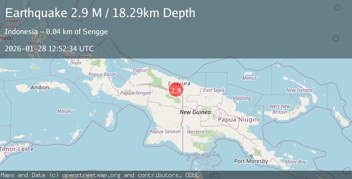
A 2.9 magnitude earthquake struck on West Papua, Indonesia, at Wed, 28 Jan 2026 12:52:34 GMT. Depth: 18.290215km. Reviewed by BMKG seismologists, this minor quake occurred at a magnitude type of M.
Magnitude
2.9
M
Source
BMKG
Intensity
-
Agency Reports
1 Sources| Source | Magnitude | Depth | Time |
|---|---|---|---|
| BMKGPrimary | 2.9 | 18 km | 1 hour ago |
Earthquake Details
AutomaticEvent IDbmg2026byib
Tsunami PotentialNo
Magnitude TypeM
Nearest Places
- Kampung Molof3.3 km
- Keerom River7.6 km
- Pauwasi8.7 km
- Kiveh10.2 km
- Molof15.5 km
Comments
Join the discussion about this event.
Latest Earthquakes
2.6Mag
Minahassa Peninsula, Sulawesi
Time1 hour ago
Depth116.64 km
SourceBMKG (Automatic)
3.2Mag
South of Sumbawa, Indonesia
Time1 hour ago
Depth16.06 km
SourceBMKG (Automatic)
0.8Mag
7 km WNW of Cobb, CA
Time1 hour ago
Depth2.06 km
SourceUSGS (Automatic)
4.1Mag
Off West Coast of Northern Sumatra
Time1 hour ago
Depth31.85 km
SourceBMKG (Automatic)
4.0Mag
OAXACA, MEXICO
Time1 hour ago
Depth17.90 km
SourceUNM (Automatic)
Nearby Earthquakes
2.8Mag
West Papua, Indonesia
Time10 hours ago
Depth61.32 km
SourceBMKG (Automatic)
3.1Mag
West Papua, Indonesia
Time6 days ago
Depth41.57 km
SourceBMKG (Automatic)
3.7Mag
West Papua, Indonesia
Time1 day ago
Depth73.14 km
SourceBMKG (Automatic)
2.6Mag
West Papua, Indonesia
Time3 days ago
Depth22.39 km
SourceBMKG (Automatic)
2.8Mag
West Papua, Indonesia
Time4 days ago
Depth10.00 km
SourceBMKG (Automatic)