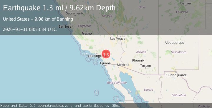
Earthquake 2 km NNW of Banning, CA
Sat, 31 Jan 2026 08:53:34 GMT
Time1 hour ago
Location
33.9462, -116.8852
Depth
9.6 KM
Event Summary
A 1.3 magnitude earthquake struck on 2 km NNW of Banning, CA, at Sat, 31 Jan 2026 08:53:34 GMT. Depth: 9.61999988555908km. Reviewed by USGS seismologists, this minor quake occurred at a magnitude type of ml.
Magnitude
1.3
ml
Source
USGS
Intensity
-
Agency Reports
1 Sources| Source | Magnitude | Depth | Time |
|---|---|---|---|
| USGSPrimary | 1.3 | 10 km | 1 hour ago |
Earthquake Details
AutomaticEvent IDusgs_ci41177135
Tsunami PotentialNo
Magnitude Typeml
Nearest Places
- San Gorgonio Memorial Park0.6 km
- Saint Boniface School0.9 km
- Mias Canyon0.9 km
- City of Banning1.3 km
- Banning Canyon1.4 km
Comments
Join the discussion about this event.
Latest Earthquakes
1.4Mag
12 km E of Desert Hot Springs, CA
Time18 minutes ago
Depth5.66 km
SourceUSGS (Automatic)
2.9Mag
NICARAGUA
Time23 minutes ago
Depth82.00 km
SourceINET (Automatic)
3.1Mag
OFF COAST OF COSTA RICA
Time27 minutes ago
Depth10.00 km
SourceUNA (Automatic)
3.8Mag
NEGROS- CEBU REG, PHILIPPINES
Time28 minutes ago
Depth9.00 km
SourcePIVS (Automatic)
4.5Mag
OAXACA, MEXICO
Time29 minutes ago
Depth51.90 km
SourceNEIC (Automatic)
Nearby Earthquakes
1.1Mag
6 km NNE of Banning, CA
Time4 days ago
Depth8.23 km
SourceUSGS (Automatic)
1.3Mag
4 km ESE of Beaumont, CA
Time5 days ago
Depth4.70 km
SourceUSGS (Automatic)
1.4Mag
8 km NNE of Banning, CA
Time6 days ago
Depth12.57 km
SourceUSGS (Automatic)
1.4Mag
7 km NNE of Beaumont, CA
Time1 day ago
Depth8.31 km
SourceUSGS (Automatic)
1.2Mag
10 km NNE of Cabazon, CA
Time2 days ago
Depth17.19 km
SourceUSGS (Automatic)