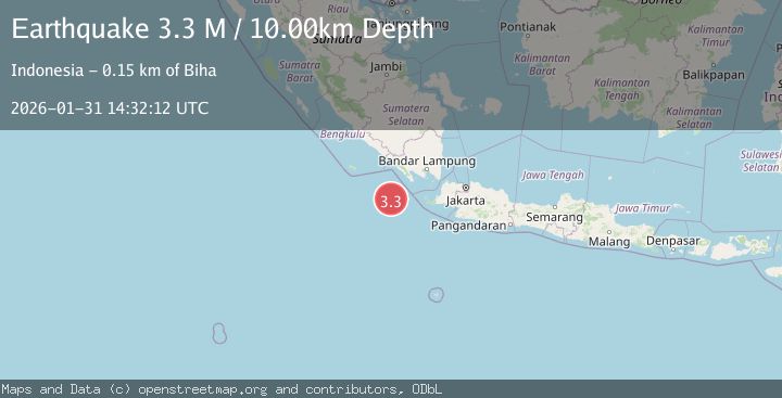
Earthquake Sunda Strait, Indonesia
Sat, 31 Jan 2026 14:32:14 GMT
Time1 hour ago
Location
-6.4847, 104.0217
Depth
10.0 KM
Event Summary
A 3.2 magnitude earthquake struck on Sunda Strait, Indonesia, at Sat, 31 Jan 2026 14:32:14 GMT. Depth: 10km. Reviewed by BMKG seismologists, this minor quake occurred at a magnitude type of M.
Magnitude
3.2
M
Source
BMKG
Intensity
-
Agency Reports
1 Sources| Source | Magnitude | Depth | Time |
|---|---|---|---|
| BMKGPrimary | 3.2 | 10 km | 1 hour ago |
Earthquake Details
AutomaticEvent IDbmg2026cdxw
Tsunami PotentialNo
Magnitude TypeM
Nearest Places
- Tanjung Cuku Balimbing53.3 km
- Enggano Basin61.7 km
- Pulau Betuah80.7 km
- Ujung Saleman86.6 km
- Cuku Belimbing86.7 km
Comments
Join the discussion about this event.
Latest Earthquakes
1.5Mag
WESTERN TURKEY
Time1 hour ago
Depth9.60 km
SourceAFAD (Automatic)
1.3Mag
50 km WNW of Tatitlek, Alaska
Time2 hours ago
Depth22.00 km
SourceUSGS (Automatic)
3.0Mag
TARAPACA, CHILE
Time2 hours ago
Depth95.00 km
SourceCSN (Automatic)
2.0Mag
10 km WSW of Stanton, Texas
Time2 hours ago
Depth3.62 km
SourceUSGS (Automatic)
2.5Mag
DODECANESE IS.-TURKEY BORDER REG
Time2 hours ago
Depth68.00 km
SourceKOERI (Automatic)
Nearby Earthquakes
2.5Mag
Sunda Strait, Indonesia
Time20 hours ago
Depth6.74 km
SourceBMKG (Automatic)
2.9Mag
Sunda Strait, Indonesia
Time1 day ago
Depth14.97 km
SourceBMKG (Automatic)
2.6Mag
Southwest of Sumatra, Indonesia
Time21 hours ago
Depth10.00 km
SourceBMKG (Automatic)
4.0Mag
Sunda Strait, Indonesia
Time6 days ago
Depth10.00 km
SourceBMKG (Automatic)
3.5Mag
Southwest of Sumatra, Indonesia
Time1 day ago
Depth27.10 km
SourceBMKG (Automatic)