Earthquake Southwest of Sumatra, Indonesia
Fri, 30 Jan 2026 18:51:46 GMT
Time3 hours ago
Location
-6.3835, 103.7440
Depth
10.0 KM
Event Summary
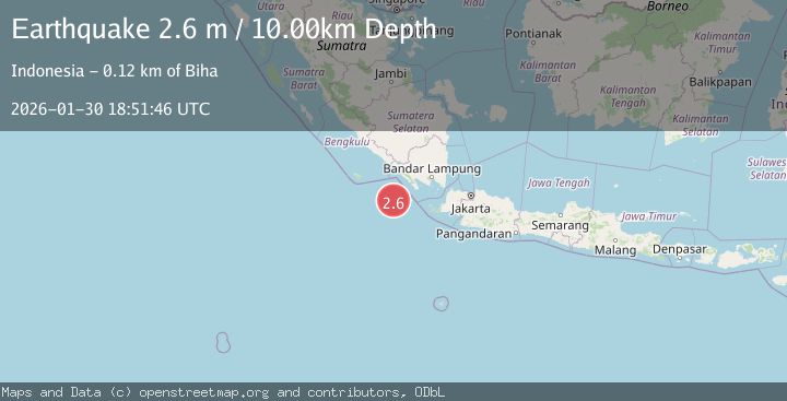
A 2.6 magnitude earthquake struck on Southwest of Sumatra, Indonesia, at Fri, 30 Jan 2026 18:51:46 GMT. Depth: 10km. Reviewed by BMKG seismologists, this minor quake occurred at a magnitude type of M.
Magnitude
2.6
M
Source
BMKG
Intensity
-
Agency Reports
1 Sources| Source | Magnitude | Depth | Time |
|---|---|---|---|
| BMKGPrimary | 2.6 | 10 km | 3 hours ago |
Earthquake Details
AutomaticEvent IDbmg2026cckz
Tsunami PotentialNo
Magnitude TypeM
Nearest Places
- Enggano Basin42.6 km
- Tanjung Cuku Balimbing83.7 km
- Pulau Betuah94.6 km
- Cuku Belimbing103.8 km
- Belimbing103.9 km
Comments
Join the discussion about this event.
Latest Earthquakes
2.2Mag
West Papua, Indonesia
Time3 hours ago
Depth99.11 km
SourceBMKG (Automatic)
3.5Mag
Talaud Islands, Indonesia
Time3 hours ago
Depth10.00 km
SourceBMKG (Automatic)
3.4Mag
SAN FRANCISCO BAY AREA, CALIF.
Time3 hours ago
Depth6.70 km
SourceNC (Automatic)
2.9Mag
CRETE, GREECE
Time3 hours ago
Depth17.30 km
SourceNOA (Automatic)
3.9Mag
PHILIPPINE ISLANDS REGION
Time3 hours ago
Depth4.00 km
SourcePIVS (Automatic)
Nearby Earthquakes
3.5Mag
Southwest of Sumatra, Indonesia
Time1 day ago
Depth27.10 km
SourceBMKG (Automatic)
3.3Mag
Southwest of Sumatra, Indonesia
Time3 days ago
Depth25.24 km
SourceBMKG (Automatic)
3.7Mag
Southwest of Sumatra, Indonesia
Time5 days ago
Depth3.70 km
SourceBMKG (Automatic)
3.2Mag
Southwest of Sumatra, Indonesia
Time13 hours ago
Depth26.83 km
SourceBMKG (Automatic)
2.9Mag
SOUTHWEST OF SUMATRA, INDONESIA
Time1 week ago
Depth10.00 km
SourceBMKG (Automatic)