Earthquake 50 km WNW of Tatitlek, Alaska
Sat, 31 Jan 2026 14:21:56 GMT
Time2 hours ago
Location
61.0980, -147.4710
Depth
22.0 KM
Event Summary
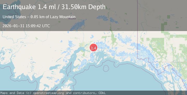
A 1.4 magnitude earthquake struck on 50 km WNW of Tatitlek, Alaska, at Sat, 31 Jan 2026 14:21:56 GMT. Depth: 22km. Reviewed by USGS seismologists, this minor quake occurred at a magnitude type of ml.
Magnitude
1.4
ml
Source
USGS
Intensity
-
Agency Reports
1 Sources| Source | Magnitude | Depth | Time |
|---|---|---|---|
| USGSPrimary | 1.4 | 32 km | 1 hour ago |
Earthquake Details
AutomaticEvent IDusgs_ak2026ceejdy
Tsunami PotentialNo
Magnitude Typeml
Nearest Places
- Miners Lake2.4 km
- Miners River3.3 km
- Miners Bay3.5 km
- Brilliant Glacier4.1 km
- Ranney Creek6.8 km
Comments
Join the discussion about this event.
Latest Earthquakes
2.2Mag
Sumbawa Region, Indonesia
Time3 minutes ago
Depth37.93 km
SourceBMKG (Automatic)
2.5Mag
ISLAND OF HAWAII, HAWAII
Time4 minutes ago
Depth32.00 km
SourceHV (Automatic)
2.3Mag
Java, Indonesia
Time9 minutes ago
Depth68.79 km
SourceBMKG (Automatic)
3.7Mag
Southern Sumatra, Indonesia
Time15 minutes ago
Depth12.10 km
SourceBMKG (Automatic)
1.0Mag
22 km ENE of Little Lake, CA
Time16 minutes ago
Depth1.48 km
SourceUSGS (Automatic)
Nearby Earthquakes
1.3Mag
47 km WNW of Tatitlek, Alaska
Time1 week ago
Depth5.00 km
SourceUSGS (Automatic)
1.5Mag
52 km WNW of Tatitlek, Alaska
Time1 week ago
Depth7.30 km
SourceUSGS (Automatic)
1.8Mag
48 km NW of Tatitlek, Alaska
Time1 day ago
Depth17.40 km
SourceUSGS (Automatic)
3.5Mag
45 km NW of Tatitlek, Alaska
Time4 days ago
Depth13.60 km
SourceUSGS (Automatic)
1.0Mag
61 km NE of Whittier, Alaska
Time1 week ago
Depth46.70 km
SourceUSGS (Automatic)