Earthquake Banda Sea
Sat, 31 Jan 2026 21:21:51 GMT
Time3 days ago
Location
-6.5437, 130.7569
Depth
110.1 KM
Event Summary
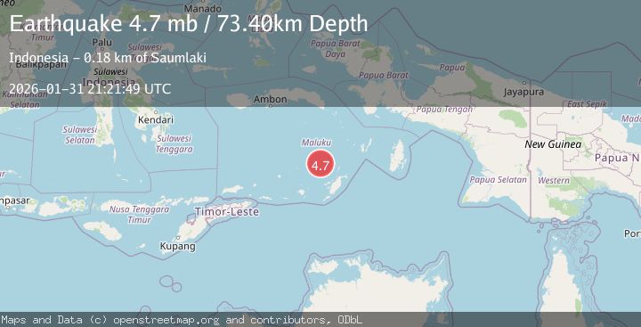
A 5.2 magnitude earthquake struck on Banda Sea, at Sat, 31 Jan 2026 21:21:51 GMT. Depth: 110.077538km. Reviewed by BMKG seismologists, this moderate quake occurred at a magnitude type of M.
Magnitude
5.2
M
Source
BMKG
Intensity
-
Agency Reports
4 Sources| Source | Magnitude | Depth | Time |
|---|---|---|---|
| BMKGPrimary | 5.2 | 110 km | 3 days ago |
| EMSC | 5.2 | 108 km | 3 days ago |
| USGS | 4.7 | 73 km | 3 days ago |
| NEIC | 4.7 | 73 km | 3 days ago |
Earthquake Details
AutomaticEvent IDbmg2026celj
Tsunami PotentialNo
Magnitude TypeM
Nearest Places
- Kepulauan Selatan Daya23.0 km
- Weber Basin66.2 km
- Waru84.4 km
- Pulau Serua85.9 km
- Lesluru87.0 km
Comments
Join the discussion about this event.
Latest Earthquakes
5.2Mag
Tanimbar Islands Region, Indonesia
Time16 hours ago
Depth101.19 km
SourceBMKG (Automatic)
1.3Mag
SWITZERLAND
Time16 hours ago
Depth0.80 km
SourceETHZ (Automatic)
1.6Mag
3 km ESE of San Ramon, CA
Time16 hours ago
Depth0.08 km
SourceUSGS (Automatic)
2.0Mag
WESTERN TEXAS
Time16 hours ago
Depth4.40 km
SourceTX (Automatic)
4.2Mag
Banda Sea
Time16 hours ago
Depth112.63 km
SourceBMKG (Automatic)
Nearby Earthquakes
3.4Mag
Banda Sea
Time1 week ago
Depth159.46 km
SourceBMKG (Automatic)
3.7Mag
Banda Sea
Time3 days ago
Depth10.00 km
SourceBMKG (Automatic)
5.5Mag
Banda Sea
Time1 week ago
Depth155.21 km
SourceBMKG (Automatic)
3.5Mag
KEP. TANIMBAR REGION, INDONESIA
Time3 days ago
Depth14.00 km
SourceBMKG (Automatic)
3.9Mag
Banda Sea
Time1 week ago
Depth247.75 km
SourceBMKG (Automatic)