Earthquake KEP. TANIMBAR REGION, INDONESIA
Sun, 01 Feb 2026 15:57:16 GMT
Time3 days ago
Location
-6.3200, 131.1100
Depth
14.0 KM
Event Summary
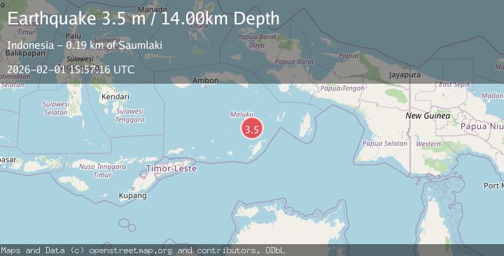
A 3.5 magnitude earthquake struck on KEP. TANIMBAR REGION, INDONESIA, at Sun, 01 Feb 2026 15:57:16 GMT. Depth: 14km. Reviewed by BMKG seismologists, this minor quake occurred at a magnitude type of m.
Magnitude
3.5
m
Source
BMKG
Intensity
-
Agency Reports
1 Sources| Source | Magnitude | Depth | Time |
|---|---|---|---|
| BMKGPrimary | 3.5 | 14 km | 3 days ago |
Earthquake Details
AutomaticEvent IDemsc_BMKG_20260201_0000216
Tsunami PotentialNo
Magnitude Typem
Nearest Places
- Weber Basin37.6 km
- Kepulauan Selatan Daya62.2 km
- Nuhututul64.6 km
- Pulau Kalbur65.1 km
- Melwuarniweyar65.4 km
Comments
Join the discussion about this event.
Latest Earthquakes
2.5Mag
NEAR S.E. COAST OF AUSTRALIA
Time12 minutes ago
Depth3.00 km
SourceAUST (Automatic)
2.3Mag
Sulawesi, Indonesia
Time15 minutes ago
Depth5.00 km
SourceBMKG (Automatic)
1.4Mag
16 km NW of Midland, Texas
Time22 minutes ago
Depth5.84 km
SourceUSGS (Automatic)
3.6Mag
GUATEMALA
Time25 minutes ago
Depth2.00 km
SourceINET (Automatic)
4.0Mag
Banda Sea
Time26 minutes ago
Depth272.05 km
SourceBMKG (Automatic)
Nearby Earthquakes
3.3Mag
Tanimbar Islands Region, Indonesia
Time3 days ago
Depth209.05 km
SourceBMKG (Automatic)
3.8Mag
Tanimbar Islands Region, Indonesia
Time4 days ago
Depth84.48 km
SourceBMKG (Automatic)
3.4Mag
Banda Sea
Time1 week ago
Depth159.46 km
SourceBMKG (Automatic)
5.2Mag
Banda Sea
Time3 days ago
Depth110.08 km
SourceBMKG (Automatic)
5.5Mag
Banda Sea
Time1 week ago
Depth155.21 km
SourceBMKG (Automatic)