Earthquake Banda Sea
Wed, 04 Feb 2026 00:09:56 GMT
Time16 hours ago
Location
-5.0037, 131.8102
Depth
94.9 KM
Event Summary
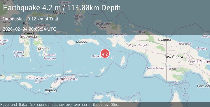
A 3.7 magnitude earthquake struck on Banda Sea, at Wed, 04 Feb 2026 00:09:56 GMT. Depth: 94.889206km. Reviewed by BMKG seismologists, this minor quake occurred at a magnitude type of M.
Magnitude
3.7
M
Source
BMKG
Intensity
-
Agency Reports
1 Sources| Source | Magnitude | Depth | Time |
|---|---|---|---|
| BMKGPrimary | 3.7 | 95 km | 16 hours ago |
Earthquake Details
AutomaticEvent IDbmg2026ckdl
Tsunami PotentialNo
Magnitude TypeM
Nearest Places
- Pulau Bui25.3 km
- Lebonminyar26.8 km
- Desa Kiliwouw27.4 km
- Pulau Tengah27.7 km
- Pulau Uran27.9 km
Comments
Join the discussion about this event.
Latest Earthquakes
2.7Mag
Minahassa Peninsula, Sulawesi
Time16 hours ago
Depth251.66 km
SourceBMKG (Automatic)
1.1Mag
8 km SW of Lytle Creek, CA
Time16 hours ago
Depth9.81 km
SourceUSGS (Automatic)
3.2Mag
NORTH ISLAND OF NEW ZEALAND
Time16 hours ago
Depth89.60 km
SourceGNS (Automatic)
3.0Mag
TARAPACA, CHILE
Time17 hours ago
Depth119.70 km
SourceCSN (Automatic)
2.2Mag
WESTERN TURKEY
Time17 hours ago
Depth5.30 km
SourceKOERI (Automatic)
Nearby Earthquakes
3.6Mag
Banda Sea
Time1 week ago
Depth132.89 km
SourceBMKG (Automatic)
3.8Mag
Banda Sea
Time1 week ago
Depth164.97 km
SourceBMKG (Automatic)
3.1Mag
West Papua Region, Indonesia
Time1 week ago
Depth10.00 km
SourceBMKG (Automatic)
3.8Mag
Tanimbar Islands Region, Indonesia
Time4 days ago
Depth84.48 km
SourceBMKG (Automatic)
3.3Mag
Tanimbar Islands Region, Indonesia
Time3 days ago
Depth209.05 km
SourceBMKG (Automatic)