Earthquake Sumbawa Region, Indonesia
Sun, 01 Feb 2026 07:17:45 GMT
Time1 day ago
Location
-9.4522, 117.0761
Depth
31.8 KM
Event Summary
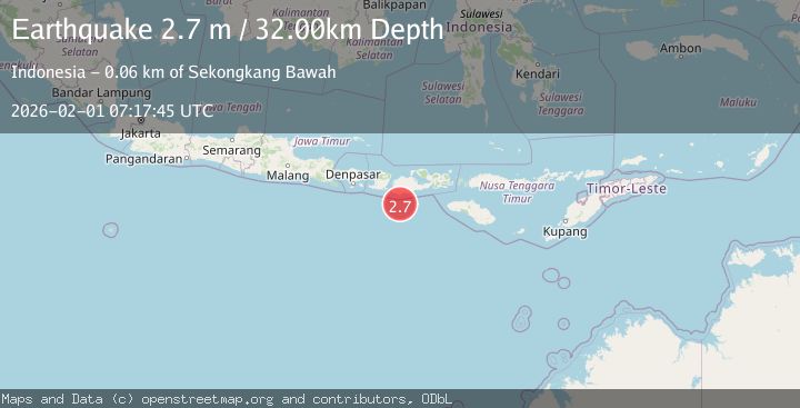
A 2.7 magnitude earthquake struck on Sumbawa Region, Indonesia, at Sun, 01 Feb 2026 07:17:45 GMT. Depth: 31.811216km. Reviewed by BMKG seismologists, this minor quake occurred at a magnitude type of M.
Magnitude
2.7
M
Source
BMKG
Intensity
-
Agency Reports
1 Sources| Source | Magnitude | Depth | Time |
|---|---|---|---|
| BMKGPrimary | 2.7 | 32 km | 1 day ago |
Earthquake Details
AutomaticEvent IDbmg2026cffa
Tsunami PotentialNo
Magnitude TypeM
Nearest Places
- Tanjung Talonan37.6 km
- Tanu Tanjunglilin38.7 km
- Tanjung Moneh40.3 km
- Tanjung Sarang Ode41.1 km
- Batu Lawang41.3 km
Comments
Join the discussion about this event.
Latest Earthquakes
4.2Mag
Sumbawa Region, Indonesia
Time7 hours ago
Depth10.00 km
SourceBMKG (Automatic)
0.7Mag
5 km NNW of The Geysers, CA
Time7 hours ago
Depth1.68 km
SourceUSGS (Automatic)
2.6Mag
Flores Region, Indonesia
Time7 hours ago
Depth8.34 km
SourceBMKG (Automatic)
2.5Mag
Northern Sumatra, Indonesia
Time7 hours ago
Depth198.72 km
SourceBMKG (Automatic)
3.0Mag
COOK STRAIT, NEW ZEALAND
Time7 hours ago
Depth99.80 km
SourceGNS (Automatic)
Nearby Earthquakes
2.2Mag
Sumbawa Region, Indonesia
Time2 days ago
Depth37.93 km
SourceBMKG (Automatic)
2.5Mag
Sumbawa Region, Indonesia
Time3 days ago
Depth26.99 km
SourceBMKG (Automatic)
2.2Mag
Sumbawa Region, Indonesia
Time16 hours ago
Depth25.12 km
SourceBMKG (Automatic)
2.4Mag
Sumbawa Region, Indonesia
Time1 day ago
Depth20.60 km
SourceBMKG (Automatic)
2.3Mag
Sumbawa Region, Indonesia
Time1 day ago
Depth40.80 km
SourceBMKG (Automatic)