Earthquake West Papua Region, Indonesia
Mon, 02 Feb 2026 15:56:52 GMT
Time1 hour ago
Location
-3.5229, 135.8144
Depth
10.0 KM
Event Summary
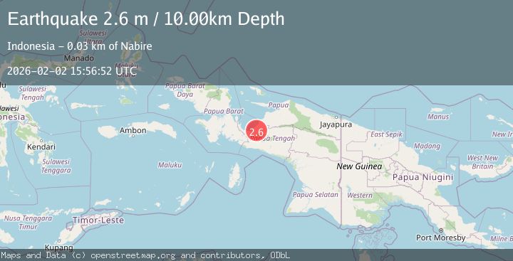
A 2.5 magnitude earthquake struck on West Papua Region, Indonesia, at Mon, 02 Feb 2026 15:56:52 GMT. Depth: 10km. Reviewed by BMKG seismologists, this minor quake occurred at a magnitude type of M.
Magnitude
2.5
M
Source
BMKG
Intensity
-
Agency Reports
1 Sources| Source | Magnitude | Depth | Time |
|---|---|---|---|
| BMKGPrimary | 2.5 | 10 km | 1 hour ago |
Earthquake Details
AutomaticEvent IDbmg2026chrr
Tsunami PotentialNo
Magnitude TypeM
Nearest Places
- Utuwa7.3 km
- Sawa8.8 km
- Kampung Unipo11.7 km
- Kampung Urumusu13.8 km
- Kampung Gamei Biru17.4 km
Comments
Join the discussion about this event.
Latest Earthquakes
2.6Mag
South of Java, Indonesia
Time1 hour ago
Depth6.67 km
SourceBMKG (Automatic)
2.1Mag
HAWAII REGION, HAWAII
Time1 hour ago
Depth2.60 km
SourceHV (Automatic)
2.8Mag
Seram, Indonesia
Time2 hours ago
Depth3.74 km
SourceBMKG (Automatic)
2.5Mag
67 km E of Port Alsworth, Alaska
Time2 hours ago
Depth130.60 km
SourceUSGS (Automatic)
3.8Mag
5 km SE of San Ramon, CA
Time2 hours ago
Depth8.67 km
SourceUSGS (Automatic)
Nearby Earthquakes
3.5Mag
West Papua Region, Indonesia
Time4 days ago
Depth11.71 km
SourceBMKG (Automatic)
2.4Mag
West Papua Region, Indonesia
Time1 week ago
Depth14.61 km
SourceBMKG (Automatic)
3.0Mag
PAPUA, INDONESIA
Time1 week ago
Depth10.00 km
SourceBMKG (Automatic)
3.5Mag
West Papua Region, Indonesia
Time3 days ago
Depth44.97 km
SourceBMKG (Automatic)
3.7Mag
West Papua Region, Indonesia
Time6 days ago
Depth127.10 km
SourceBMKG (Automatic)