Earthquake Northern Sumatra, Indonesia
Mon, 02 Feb 2026 18:05:30 GMT
Time2 hours ago
Location
4.2016, 97.4617
Depth
5.0 KM
Event Summary
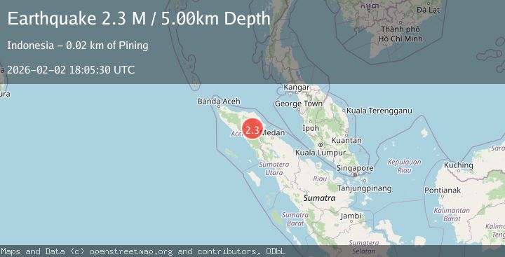
A 2.3 magnitude earthquake struck on Northern Sumatra, Indonesia, at Mon, 02 Feb 2026 18:05:30 GMT. Depth: 5km. Reviewed by BMKG seismologists, this minor quake occurred at a magnitude type of M.
Magnitude
2.3
M
Source
BMKG
Intensity
-
Agency Reports
1 Sources| Source | Magnitude | Depth | Time |
|---|---|---|---|
| BMKGPrimary | 2.3 | 5 km | 2 hours ago |
Earthquake Details
AutomaticEvent IDbmg2026chvx
Tsunami PotentialNo
Magnitude TypeM
Nearest Places
- Gunung Gemiring2.4 km
- Arul Pepelah2.6 km
- Gunung Aber3.3 km
- Gunung Lojang3.5 km
- Gunung Lembu3.7 km
Comments
Join the discussion about this event.
Latest Earthquakes
2.2Mag
43 km SE of Denali National Park, Alaska
Time2 hours ago
Depth5.00 km
SourceUSGS (Automatic)
2.8Mag
LA RIOJA, ARGENTINA
Time2 hours ago
Depth10.00 km
SourceNSNA (Automatic)
2.0Mag
NORTHERN ITALY
Time2 hours ago
Depth5.00 km
SourceLDG (Automatic)
2.1Mag
Sumbawa Region, Indonesia
Time2 hours ago
Depth96.66 km
SourceBMKG (Automatic)
2.0Mag
9 km NE of Coso Junction, CA
Time2 hours ago
Depth2.78 km
SourceUSGS (Automatic)
Nearby Earthquakes
2.2Mag
Northern Sumatra, Indonesia
Time1 week ago
Depth1.65 km
SourceBMKG (Automatic)
2.2Mag
Northern Sumatra, Indonesia
Time3 days ago
Depth10.00 km
SourceBMKG (Automatic)
2.4Mag
Northern Sumatra, Indonesia
Time6 days ago
Depth1.40 km
SourceBMKG (Automatic)
2.2Mag
Northern Sumatra, Indonesia
Time2 days ago
Depth13.04 km
SourceBMKG (Automatic)
2.9Mag
Northern Sumatra, Indonesia
Time2 days ago
Depth5.00 km
SourceBMKG (Automatic)