Earthquake Northern Sumatra, Indonesia
Wed, 04 Feb 2026 03:19:47 GMT
Time9 hours ago
Location
4.1788, 97.4362
Depth
5.0 KM
Event Summary
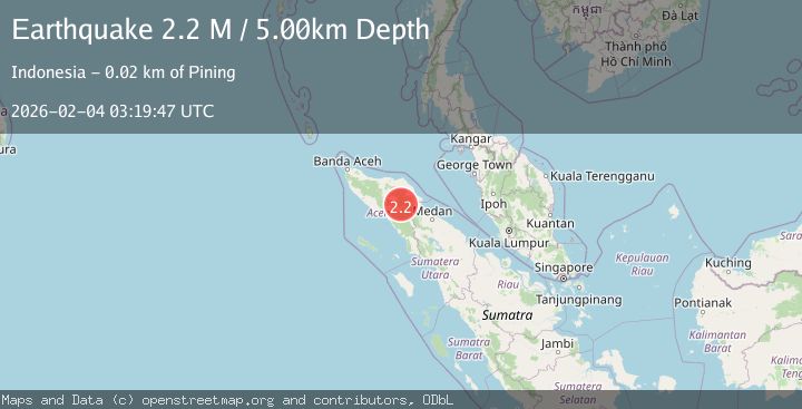
A 2.2 magnitude earthquake struck on Northern Sumatra, Indonesia, at Wed, 04 Feb 2026 03:19:47 GMT. Depth: 5km. Reviewed by BMKG seismologists, this minor quake occurred at a magnitude type of M.
Magnitude
2.2
M
Source
BMKG
Intensity
-
Agency Reports
1 Sources| Source | Magnitude | Depth | Time |
|---|---|---|---|
| BMKGPrimary | 2.2 | 5 km | 9 hours ago |
Earthquake Details
AutomaticEvent IDbmg2026ckjs
Tsunami PotentialNo
Magnitude TypeM
Nearest Places
- Gunung Lojang0.5 km
- Gunung Aber1.8 km
- Burni Siluman3.5 km
- Gunung Gemiring3.8 km
- Burni Pepelar4.2 km
Comments
Join the discussion about this event.
Latest Earthquakes
1.1Mag
7 km W of Cobb, CA
Time9 hours ago
Depth1.71 km
SourceUSGS (Automatic)
3.6Mag
Minahassa Peninsula, Sulawesi
Time9 hours ago
Depth11.54 km
SourceBMKG (Automatic)
4.2Mag
KURIL ISLANDS
Time9 hours ago
Depth50.00 km
SourceJMA (Automatic)
2.5Mag
CENTRAL ITALY
Time9 hours ago
Depth20.90 km
SourceINGV (Automatic)
0.6Mag
SWITZERLAND
Time9 hours ago
Depth-0.20 km
SourceETHZ (Automatic)
Nearby Earthquakes
2.1Mag
Northern Sumatra, Indonesia
Time2 days ago
Depth2.00 km
SourceBMKG (Automatic)
2.3Mag
Northern Sumatra, Indonesia
Time2 days ago
Depth1.11 km
SourceBMKG (Automatic)
2.7Mag
Northern Sumatra, Indonesia
Time1 week ago
Depth0.60 km
SourceBMKG (Automatic)
2.4Mag
Northern Sumatra, Indonesia
Time3 days ago
Depth5.00 km
SourceBMKG (Automatic)
2.4Mag
Northern Sumatra, Indonesia
Time1 week ago
Depth5.00 km
SourceBMKG (Automatic)