Earthquake Northern Sumatra, Indonesia
Mon, 02 Feb 2026 03:42:08 GMT
Time19 hours ago
Location
4.1670, 97.4444
Depth
1.1 KM
Event Summary
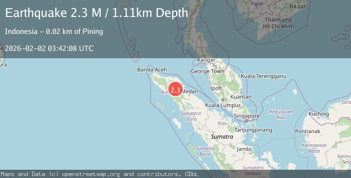
A 2.3 magnitude earthquake struck on Northern Sumatra, Indonesia, at Mon, 02 Feb 2026 03:42:08 GMT. Depth: 1.114214km. Reviewed by BMKG seismologists, this minor quake occurred at a magnitude type of M.
Magnitude
2.3
M
Source
BMKG
Intensity
-
Agency Reports
1 Sources| Source | Magnitude | Depth | Time |
|---|---|---|---|
| BMKGPrimary | 2.3 | 1 km | 19 hours ago |
Earthquake Details
AutomaticEvent IDbmg2026cgtl
Tsunami PotentialNo
Magnitude TypeM
Nearest Places
- Gunung Aber1.1 km
- Gunung Lojang2.0 km
- Burni Siluman3.3 km
- Burni Pepelar4.6 km
- Gunung Gemiring5.0 km
Comments
Join the discussion about this event.
Latest Earthquakes
2.1Mag
Bali Sea
Time19 hours ago
Depth10.00 km
SourceBMKG (Automatic)
1.0Mag
7 km NNW of Santa Paula, CA
Time19 hours ago
Depth9.99 km
SourceUSGS (Automatic)
1.5Mag
NORTHERN ITALY
Time20 hours ago
Depth0.00 km
SourceETHZ (Automatic)
2.1Mag
NORTHERN ITALY
Time20 hours ago
Depth34.10 km
SourceINGV (Automatic)
0.8Mag
21 km ESE of Julian, CA
Time20 hours ago
Depth12.24 km
SourceUSGS (Automatic)
Nearby Earthquakes
2.6Mag
Northern Sumatra, Indonesia
Time4 days ago
Depth5.00 km
SourceBMKG (Automatic)
2.4Mag
Northern Sumatra, Indonesia
Time1 week ago
Depth5.00 km
SourceBMKG (Automatic)
2.2Mag
Northern Sumatra, Indonesia
Time3 days ago
Depth13.04 km
SourceBMKG (Automatic)
2.2Mag
Northern Sumatra, Indonesia
Time3 days ago
Depth10.00 km
SourceBMKG (Automatic)
2.7Mag
Northern Sumatra, Indonesia
Time6 days ago
Depth0.60 km
SourceBMKG (Automatic)