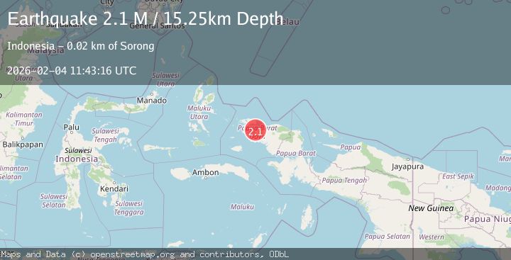
Earthquake West Papua Region, Indonesia
Wed, 04 Feb 2026 11:43:16 GMT
Time3 hours ago
Location
-0.7104, 131.2880
Depth
15.3 KM
Event Summary
A 2.1 magnitude earthquake struck on West Papua Region, Indonesia, at Wed, 04 Feb 2026 11:43:16 GMT. Depth: 15.25129km. Reviewed by BMKG seismologists, this minor quake occurred at a magnitude type of M.
Magnitude
2.1
M
Source
BMKG
Intensity
-
Agency Reports
1 Sources| Source | Magnitude | Depth | Time |
|---|---|---|---|
| BMKGPrimary | 2.1 | 15 km | 3 hours ago |
Earthquake Details
AutomaticEvent IDbmg2026clah
Tsunami PotentialNo
Magnitude TypeM
Nearest Places
- Distrik Maladum Mes12.1 km
- Kelurahan Saoka12.3 km
- Kelurahan Tanjung Kasuari13.5 km
- Kelurahan Suprau14.2 km
- Tanjung Sorong14.3 km
Comments
Join the discussion about this event.
Latest Earthquakes
2.0Mag
6 km SE of Sunol, CA
Time2 hours ago
Depth9.29 km
SourceUSGS (Automatic)
2.9Mag
SALTA, ARGENTINA
Time3 hours ago
Depth206.00 km
SourceNSNA (Automatic)
4.2Mag
GULF OF CALIFORNIA
Time3 hours ago
Depth8.10 km
SourceUNM (Automatic)
1.7Mag
CENTRAL TURKEY
Time3 hours ago
Depth10.60 km
SourceEMSC (Automatic)
0.3Mag
6 km NW of The Geysers, CA
Time3 hours ago
Depth3.41 km
SourceUSGS (Automatic)
Nearby Earthquakes
2.3Mag
West Papua Region, Indonesia
Time3 days ago
Depth10.00 km
SourceBMKG (Automatic)
2.2Mag
West Papua Region, Indonesia
Time1 week ago
Depth10.00 km
SourceBMKG (Automatic)
2.3Mag
West Papua Region, Indonesia
Time1 week ago
Depth10.00 km
SourceBMKG (Automatic)
2.2Mag
West Papua Region, Indonesia
Time1 week ago
Depth10.00 km
SourceBMKG (Automatic)
2.6Mag
West Papua Region, Indonesia
Time2 weeks ago
Depth10.00 km
SourceBMKG (Automatic)