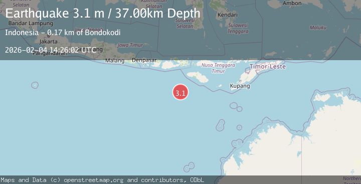
Earthquake South of Sumbawa, Indonesia
Wed, 04 Feb 2026 14:26:01 GMT
Time2 hours ago
Location
-10.9225, 118.4297
Depth
10.0 KM
Event Summary
A 3.0 magnitude earthquake struck on South of Sumbawa, Indonesia, at Wed, 04 Feb 2026 14:26:01 GMT. Depth: 10km. Reviewed by BMKG seismologists, this minor quake occurred at a magnitude type of M.
Magnitude
3.0
M
Source
BMKG
Intensity
-
Agency Reports
1 Sources| Source | Magnitude | Depth | Time |
|---|---|---|---|
| BMKGPrimary | 3.0 | 10 km | 2 hours ago |
Earthquake Details
AutomaticEvent IDbmg2026clfr
Tsunami PotentialNo
Magnitude TypeM
Nearest Places
- Tanjung Waikataku152.5 km
- Tanjung Mareha152.5 km
- Loko Waikataku152.7 km
- Pulau Malondobara152.8 km
- Pulau Barenggemonokodi152.9 km
Comments
Join the discussion about this event.
Latest Earthquakes
3.0Mag
Northern Sumatra, Indonesia
Time2 hours ago
Depth3.00 km
SourceBMKG (Automatic)
1.9Mag
12 km NNE of Coyanosa, Texas
Time2 hours ago
Depth0.00 km
SourceUSGS (Automatic)
2.3Mag
Southern Sumatra, Indonesia
Time2 hours ago
Depth62.22 km
SourceBMKG (Automatic)
2.4Mag
Sulawesi, Indonesia
Time2 hours ago
Depth2.48 km
SourceBMKG (Automatic)
1.1Mag
8 km NW of The Geysers, CA
Time2 hours ago
Depth1.76 km
SourceUSGS (Automatic)
Nearby Earthquakes
3.3Mag
South of Sumbawa, Indonesia
Time1 week ago
Depth10.00 km
SourceBMKG (Automatic)
3.1Mag
South of Sumbawa, Indonesia
Time5 days ago
Depth10.00 km
SourceBMKG (Automatic)
3.0Mag
South of Sumbawa, Indonesia
Time3 days ago
Depth0.00 km
SourceBMKG (Automatic)
3.4Mag
South of Sumbawa, Indonesia
Time2 days ago
Depth10.00 km
SourceBMKG (Automatic)
3.2Mag
South of Sumbawa, Indonesia
Time3 days ago
Depth10.00 km
SourceBMKG (Automatic)