Earthquake Banda Sea
Wed, 04 Feb 2026 21:04:17 GMT
Time2 hours ago
Location
-7.4418, 128.7975
Depth
190.9 KM
Event Summary
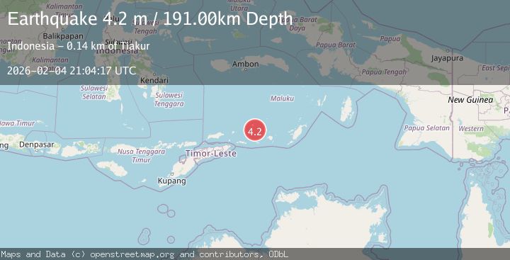
A 4.1 magnitude earthquake struck on Banda Sea, at Wed, 04 Feb 2026 21:04:17 GMT. Depth: 190.860214km. Reviewed by BMKG seismologists, this light quake occurred at a magnitude type of M.
Magnitude
4.1
M
Source
BMKG
Intensity
-
Agency Reports
1 Sources| Source | Magnitude | Depth | Time |
|---|---|---|---|
| BMKGPrimary | 4.1 | 191 km | 2 hours ago |
Earthquake Details
AutomaticEvent IDbmg2026clsv
Tsunami PotentialNo
Magnitude TypeM
Nearest Places
- Pulau Terbang Selatan27.5 km
- Tanjung Paran30.4 km
- Pulau Terbang Utara30.5 km
- Tanjung Watlewantutu31.0 km
- Tanjung Tutuwain33.2 km
Comments
Join the discussion about this event.
Latest Earthquakes
2.3Mag
Flores Sea
Time2 hours ago
Depth25.99 km
SourceBMKG (Automatic)
2.5Mag
Southern Sumatra, Indonesia
Time2 hours ago
Depth14.57 km
SourceBMKG (Automatic)
3.3Mag
South of Java, Indonesia
Time2 hours ago
Depth25.48 km
SourceBMKG (Automatic)
3.6Mag
Minahassa Peninsula, Sulawesi
Time2 hours ago
Depth3.49 km
SourceBMKG (Automatic)
2.7Mag
West Papua Region, Indonesia
Time2 hours ago
Depth10.00 km
SourceBMKG (Automatic)
Nearby Earthquakes
5.0Mag
Banda Sea
Time4 days ago
Depth160.88 km
SourceBMKG (Automatic)
3.6Mag
KEPULAUAN BARAT DAYA, INDONESIA
Time3 days ago
Depth172.00 km
SourceBMKG (Automatic)
3.8Mag
Banda Sea
Time1 week ago
Depth199.25 km
SourceBMKG (Automatic)
3.8Mag
KEPULAUAN BARAT DAYA, INDONESIA
Time1 week ago
Depth110.00 km
SourceBMKG (Automatic)
3.8Mag
Banda Sea
Time4 hours ago
Depth244.15 km
SourceBMKG (Automatic)