Earthquake Southern Sumatra, Indonesia
Wed, 04 Feb 2026 20:59:11 GMT
Time2 hours ago
Location
-0.1307, 98.7907
Depth
14.6 KM
Event Summary
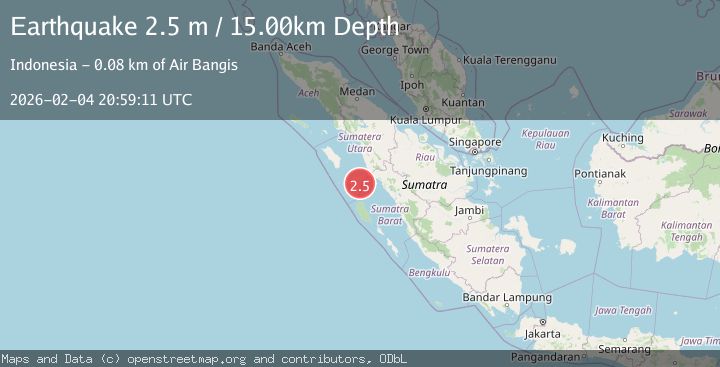
A 2.5 magnitude earthquake struck on Southern Sumatra, Indonesia, at Wed, 04 Feb 2026 20:59:11 GMT. Depth: 14.570489km. Reviewed by BMKG seismologists, this minor quake occurred at a magnitude type of M.
Magnitude
2.5
M
Source
BMKG
Intensity
-
Agency Reports
1 Sources| Source | Magnitude | Depth | Time |
|---|---|---|---|
| BMKGPrimary | 2.5 | 15 km | 2 hours ago |
Earthquake Details
AutomaticEvent IDbmg2026clsq
Tsunami PotentialNo
Magnitude TypeM
Nearest Places
- Tonga19.0 km
- Karang Anso21.6 km
- Pulau Trebakecil21.9 km
- Pulau Trebabesar23.2 km
- Pasakek-besar23.5 km
Comments
Join the discussion about this event.
Latest Earthquakes
3.3Mag
South of Java, Indonesia
Time2 hours ago
Depth25.48 km
SourceBMKG (Automatic)
3.6Mag
Minahassa Peninsula, Sulawesi
Time2 hours ago
Depth3.49 km
SourceBMKG (Automatic)
2.7Mag
West Papua Region, Indonesia
Time2 hours ago
Depth10.00 km
SourceBMKG (Automatic)
2.4Mag
Minahassa Peninsula, Sulawesi
Time2 hours ago
Depth86.87 km
SourceBMKG (Automatic)
2.2Mag
ALBANIA
Time3 hours ago
Depth15.00 km
SourceIGEO (Automatic)
Nearby Earthquakes
2.7Mag
Southern Sumatra, Indonesia
Time1 week ago
Depth22.17 km
SourceBMKG (Automatic)
3.0Mag
Southern Sumatra, Indonesia
Time2 days ago
Depth10.00 km
SourceBMKG (Automatic)
3.6Mag
Northern Sumatra, Indonesia
Time1 day ago
Depth16.81 km
SourceBMKG (Automatic)
3.6Mag
Southern Sumatra, Indonesia
Time4 days ago
Depth41.61 km
SourceBMKG (Automatic)
2.8Mag
Southern Sumatra, Indonesia
Time1 day ago
Depth43.49 km
SourceBMKG (Automatic)