Earthquake West Papua Region, Indonesia
Wed, 04 Feb 2026 20:38:00 GMT
Time2 hours ago
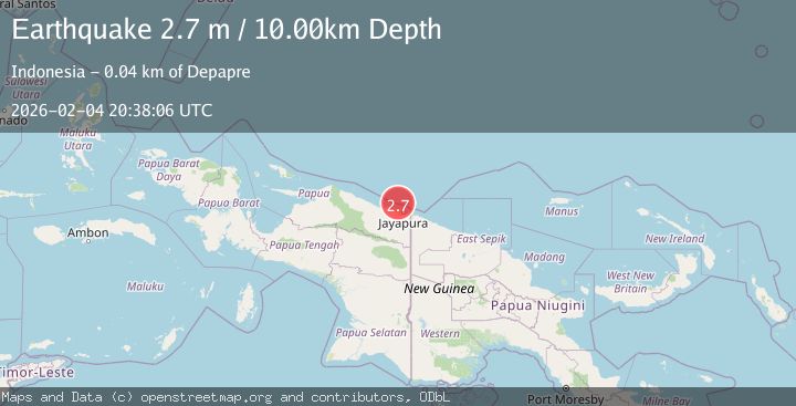
Location
-1.9266, 140.5085
Depth
10.0 KM
Event Summary
A 2.3 magnitude earthquake struck on West Papua Region, Indonesia, at Wed, 04 Feb 2026 20:38:00 GMT. Depth: 10km. Reviewed by BMKG seismologists, this minor quake occurred at a magnitude type of M.
Magnitude
2.3
M
Source
BMKG
Intensity
-
Agency Reports
1 Sources| Source | Magnitude | Depth | Time |
|---|---|---|---|
| BMKGPrimary | 2.3 | 10 km | 2 hours ago |
Earthquake Details
AutomaticEvent IDbmg2026clry
Tsunami PotentialNo
Magnitude TypeM
Nearest Places
- Jafase53.8 km
- Tanjung Tanahmerah55.1 km
- Doromena55.1 km
- Yaona56.2 km
- Sapari56.3 km
Comments
Join the discussion about this event.
Latest Earthquakes
2.4Mag
Minahassa Peninsula, Sulawesi
Time2 hours ago
Depth86.87 km
SourceBMKG (Automatic)
2.2Mag
ALBANIA
Time3 hours ago
Depth15.00 km
SourceIGEO (Automatic)
2.4Mag
Northern Sumatra, Indonesia
Time3 hours ago
Depth64.64 km
SourceBMKG (Automatic)
3.0Mag
PHILIPPINE ISLANDS REGION
Time3 hours ago
Depth32.00 km
SourcePIVS (Automatic)
1.6Mag
WESTERN TURKEY
Time3 hours ago
Depth11.80 km
SourceAFAD (Automatic)
Nearby Earthquakes
3.5Mag
West Papua Region, Indonesia
Time2 days ago
Depth10.00 km
SourceBMKG (Automatic)
2.1Mag
Near North Coast of West Papua
Time1 week ago
Depth10.00 km
SourceBMKG (Automatic)
2.8Mag
Near North Coast of West Papua
Time1 week ago
Depth12.25 km
SourceBMKG (Automatic)
2.5Mag
Near North Coast of West Papua
Time1 week ago
Depth10.00 km
SourceBMKG (Automatic)
2.6Mag
Near North Coast of West Papua
Time2 weeks ago
Depth10.00 km
SourceBMKG (Automatic)