Earthquake Southern Sumatra, Indonesia
Thu, 29 Jan 2026 17:21:40 GMT
Time5 hours ago
Location
-4.0304, 102.0260
Depth
25.3 KM
Event Summary
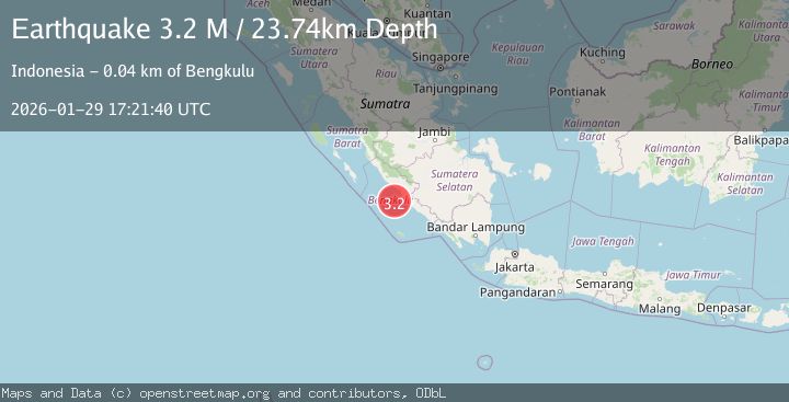
A 3.1 magnitude earthquake struck on Southern Sumatra, Indonesia, at Thu, 29 Jan 2026 17:21:40 GMT. Depth: 25.301466km. Reviewed by BMKG seismologists, this minor quake occurred at a magnitude type of M.
Magnitude
3.1
M
Source
BMKG
Intensity
-
Agency Reports
1 Sources| Source | Magnitude | Depth | Time |
|---|---|---|---|
| BMKGPrimary | 3.1 | 25 km | 5 hours ago |
Earthquake Details
AutomaticEvent IDbmg2026caml
Tsunami PotentialNo
Magnitude TypeM
Nearest Places
- Lebar Reef21.3 km
- Pulau Tikus26.9 km
- Ujung Teluk Punggur30.1 km
- Pondokkapur30.4 km
- Kelurahan Teluk Sepang30.9 km
Comments
Join the discussion about this event.
Latest Earthquakes
2.8Mag
South of Bali, Indonesia
Time6 hours ago
Depth89.10 km
SourceBMKG (Automatic)
4.5Mag
Near North Coast of Papua New Guinea
Time6 hours ago
Depth10.00 km
SourceBMKG (Automatic)
1.9Mag
138 km SSE of McCarthy, Alaska
Time6 hours ago
Depth19.30 km
SourceUSGS (Automatic)
3.5Mag
Southwest of Sumatra, Indonesia
Time6 hours ago
Depth27.10 km
SourceBMKG (Automatic)
2.3Mag
West Papua Region, Indonesia
Time6 hours ago
Depth14.18 km
SourceBMKG (Automatic)
Nearby Earthquakes
3.6Mag
Southern Sumatra, Indonesia
Time1 day ago
Depth72.51 km
SourceBMKG (Automatic)
2.6Mag
Southern Sumatra, Indonesia
Time4 days ago
Depth25.66 km
SourceBMKG (Automatic)
3.2Mag
Southern Sumatra, Indonesia
Time5 days ago
Depth10.00 km
SourceBMKG (Automatic)
3.2Mag
Southern Sumatra, Indonesia
Time1 week ago
Depth48.75 km
SourceBMKG (Automatic)
4.7Mag
Southern Sumatra, Indonesia
Time2 days ago
Depth10.00 km
SourceBMKG (Automatic)